Training: Explore and record Orford Ness
03/06/2017 | 9:40 a.m.
Orford Ness, Woodbridge, Suffolk
Owned by the National Trust, and once home to a highly secretive atomic weapons and radar testing establishment, Orford Ness is a large shingle spit with an extremely dynamic coastline and plenty for us to record. This weekend will concentrate on updating features using the CITiZAN mobile app as well as checking for eroding features along the fragile shingle shelf.
No experience is necessary and the weekend is free - CITiZAN will cover parking and ferry costs. Please note that the weekend will include a lot of walking, on paths and on shingle!
Saturday 3 June
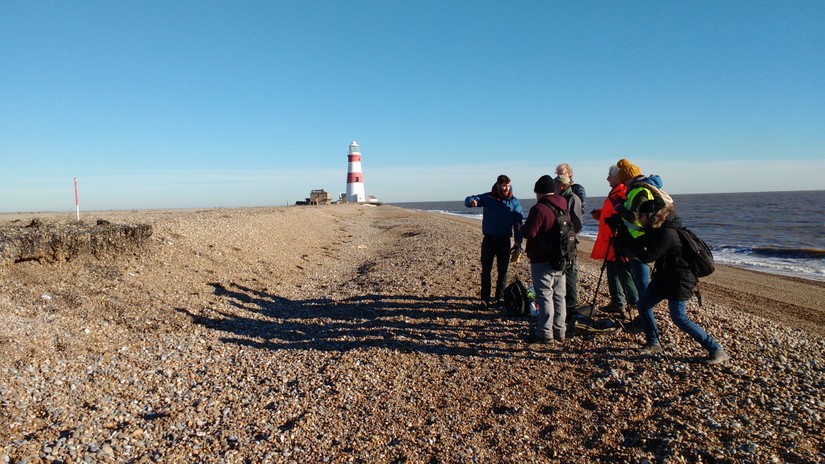
9.30am meet at Orford Quay car park in time to sort out parking tickets and catch the first visitor boat (10am) over to the Ness. We'll then walk the Blue Route then pick up the Red Route visitor trail. Armed with the 2009 Historic England survey report, we'll have an App blitz: we have a lot of entries for the buildings on Orford Ness on our map, from the National Trust database, but none of these have any photos, so we'll be adding those as well as any further written information. We'll also visit the sites we've been monitoring, along the shingle shelf and update the entries for these.
On the way we’ll have time to explore the buildings and visit the information centre exhibitions, and have the full Orford Ness visitor experience. The last boat back is 5pm, so we'll definitely be leaving by then, but you are welcome to peel off back to the boat earlier if you need to. The toal distance we'll be walking is Total distance is c 5 miles - partly on laid paths or concrete and partly on shingle.
Sunday 4 June
Meeting time at Orford Quay TBC (c. 10am)
We'll start with a classroom session at Orford Ness Basecamp. We'll have a talk on the history of Orford Ness from one of the National Trust rangers, a quick look at recent work by CITiZAN and a how-to session on documentary research, using Orford Ness as an example but applicable to any historical research. After lunch we'll take a walk north of the lighthouse along the shingle shelf (low tide 13.50). We’ve never explored that way before and aerial photographs from the 1950s show there might be features to record, if they’ve survived. If conditions are right we'll also do some photography for 3D modelling on the aircraft wing lodged in the Saltmarsh at Stoney Ditch. We'll aim to be back at Basecamp at 3.30 for a quick debrief, then head back to the boat. There'll be a simlar amount of walking involved as for Saturday.
For both days bring snacks and a picnic lunch. On Sunday, CITiZAN will provide tea, coffee and biscuits at Basecamp. For further information on access, facilities and conditions on Orford Ness see the National Trust website.
Places are limited so book early, via Eventbrite, to avoid disappointment! If you've any questions, or if you'd like to come but can only make one of the days, please contact Lara: lband@mola.org.uk or 07718 570384