Submerged forest
Submerged forest (81892)
- Easting
- 426156
- Northing
- 616968
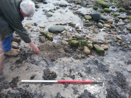
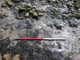
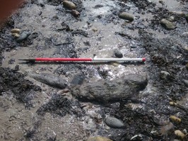
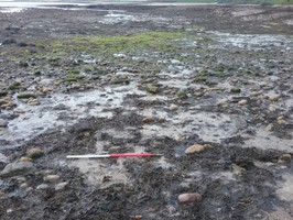
An area of submerged forest was identified that measured 8m east-west and 6m north-south. Surrounding the forest remains was a decayed peat layer with a maximum depth of 0.10m. Several un-worked fragments of wood were noted within the peatshelf, the largest of which measured 0.84m x 0.25m.
The forest was originally recorded in 1922. Remnants of oak, fir, hazel, alder and silver birch trees were identified in the surrounding peasthself along with freshwater mollusc shells.
- Period
- Prehistory (before 43AD)
- Period comments
prehistoric
- The earliest date of the feature, as a year, if known
- The latest date of the feature, as a year, if known
- Monument Type - Broad
- Archaeological feature
- Monument Type - Narrow
- Buried land surface
- Monument Description
- A former ground surface buried beneath an earthwork or other sequence of deposits (includes palaeosoils, turf lines).
- Evidence Type - Broad
- Botanical feature
- Evidence Type - Narrow
- Evidence Description
- A monument composed of plants or trees, which are still extant. Especially relevant for park and garden features. For example tree avenue, orchard, rose garden and lawn.
- Object Type - Broad
- Deposit
- Object Type - Narrow
- Peat
- Object Description
- Material consisting of at least 90% organic matter by dry weight. Formed from plant material under damp, wet or acid conditions where the rate of accumulation is greater than the rate of decay.
- Height OD (m)
- How accessible is the feature?
- Easily accessible - no restrictions, Accessible on foot (footpath)
- Accessibility comments
on the foreshore
Other records:
- NRHE Number
- Unknown
- NT HBSMR Number
- Unknown
- HER Event Number
- Unknown
- External Link
- None
Over to you...
If you know there are errors in the original feature record above, you can edit the original record
If you would like to visit the feature and carry out a 'Feature Update Survey', you can prepare a 'Feature Update Survey' pack for this feature (in PDF format)
If you have completed a 'Feature Update Survey' for this feature, you can submit your 'Feature Update Survey'
If you want to use your smart phone to carry out the 'Feature Update Survey', you can download the CITiZAN smart app.
Feature Update Surveys
1 survey accepted and 0 pending.
Click on a survey to expand it.
- Date of survey
- 7th July, 2016
- Feature located?
- Yes
- State of the tide
- Low
- Proximity to coast edge
- Intertidal zone
- Coastal processes
- Active sea erosion, Accreting
- Is there a coastal defence?
- Yes
- Other threats?
- Vegetation growth, Visitor erosion
- If other, please specify
- How visible are the remains? ABOVE GROUND
- Limited visibility (partial remains)
- How visible are the remains in the face of the cliff, ridge or dune? IN SECTION
- Not applicable
- Do you know if the feature is?
- Is well known, Has local associations/history
- What actions (if any) would you recommend for this feature?
C14 dating
- Do you have any other comments?
Photos
Submerged forest by MClement
Submerged forest by MClement
Submerged forest by MClement