Reading coastal erosion through coastal wartime concrete
29/09/2022 | Chris Kolonko
In early 2022, CITiZAN’s Team North set out to try something new. Having worked at Auburn Sands, East Yorkshire for 6 years, the team had noticed some interesting goings on with the area’s surviving wartime defences and coastal erosion.
Auburn Sands sits on the Holderness Coast; an extensive coastal area stretching from Flamborough Head in the north, to Spurn Point in the south. This section of coastline comprises mainly of soft bolder clay. This section of coast is one of the fastest eroding in the UK, as well as Europe on account of its geology. The combination of rising sea levels and increased storm events now means that the Holderness Coast of East Yorkshire is now even more vulnerable to coastal erosion and therefore loss of coastal archaeology.
While working on this ever-changing section of coast, the team had realised not only the importance of Auburn’s well preserved Second World War anti-invasion defences, but also their potential for helping us to learn about trends of coastal erosion in this area.
Areas of Interest
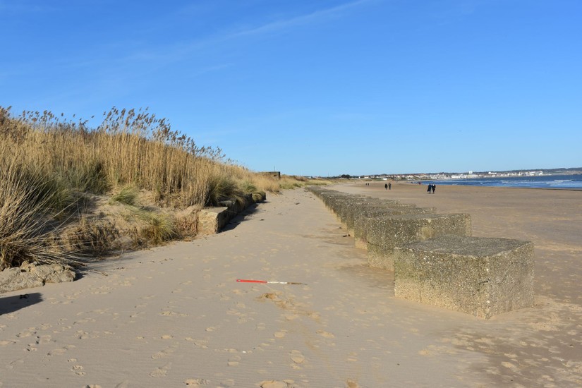
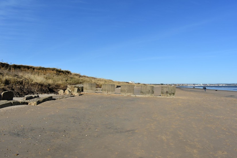
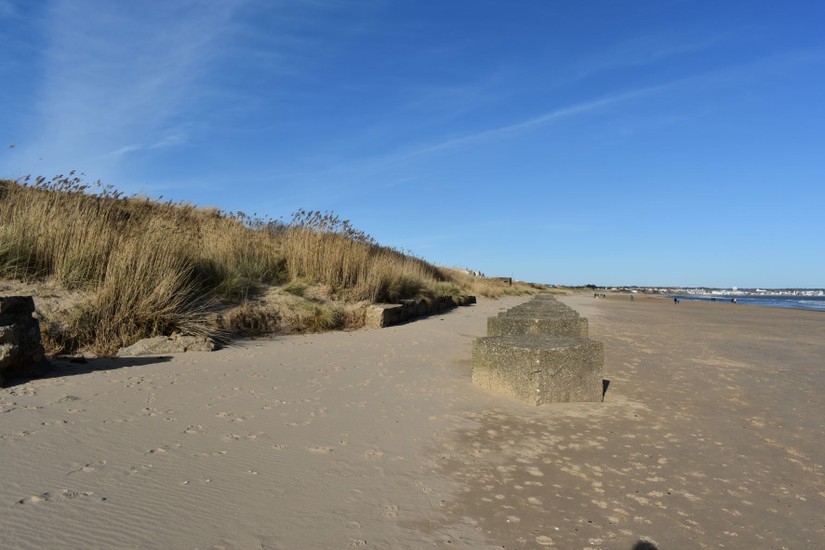
The northern extent of Auburn Sand’s beach is home to the best surviving and preserved set of Coastal Crust defences on the East Yorkshire coast. These are very much a rarity, as all other 1940s anti-invasion defences on this stretch of coast have been destroyed by erosion or only survive as fragmentary remains. This makes the Auburn Sands defences even more important from both an archaeological and historical perspective as the sole remaining legible set of early 1940s defences on the East Yorkshire coast.
During the team’s previous surveys, it had been noticed that the levels of preservation at Auburn quickly change within a very short distance, with well preserved wartime concrete giving way to highly fragmented and scattered lumps of concrete within a very short distance.
This observation raised several questions to team North’s concrete obsessed project officer about both coastal erosion and how this may hamper preservation of the site in years to come. These questions were-
Why is erosion limited to a specific area and why does it start so suddenly?
What can we learn from surviving wartime coastal defences that can inform our understanding of trends of coastal erosion from 1940 to the present day?
And finally, can we use wartime defences as a benchmark to assess and understand coastal erosion?
These were all questions that we would set out to answer.
How could we answer the questions?
Chris decided on approaching these questions by using fieldwork. Although it would be possible, to a degree, to answer some of these questions using desk-based methods only, the best way to learn about the site and erosions trends would be to get boots on the ground and do some surveying.
The team would first record the extent of the current coast edge and then record the location of surviving wartime defences. By recording the current coast edge, we would have a point of reference to compare the location of the surviving defences to, while also creating an accurate model of the coast edge at the time of survey. This was very important due to this being one of the fastest eroding coastlines in the UK.
Lines of anti-tank cubes were constructed at Auburn in July 1940 and February 1941 (Dobinson, 1996). These cubes formed extensive anti-tank obstacles that extended for miles along the Holderness coast. As had been observed from the surviving examples at Auburn, these obstacles were focussed around the base of the cliff, with additional stretches at right-angles along the beach. This was confirmed by aerial photographs of the area taken during the 1940s.
This means that surviving sections of anti-tank cubes are likely to correlate with the original cliff edge in 1940. By accurately recording the surviving lines of anti-tank cubes, or their associated fragmentary remains, it might be possible to identify the area of the coast edge in the 1940s as well as assess how much of the coastline has been lost and where it is being lost. Essentially, the anti-tank defences of the Second World War would provide us with a benchmark to work from, as well as a date for when the coast edge was located behind the anti-tank cubes.
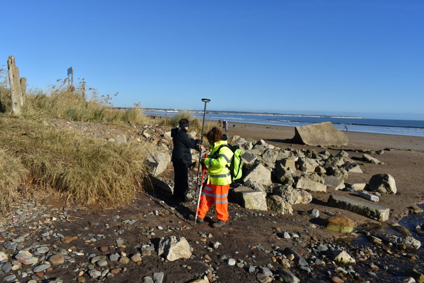
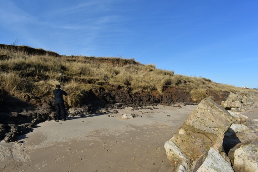
Each CITiZAN team had a really nice Leica RTK. This fancy survey grade GPS system was largely used to accurately plot and record the locations of archaeological features with an accuracy of 1cm. The teams had used their RTKs to record everything from Medieval fish traps (Link), Bronze Age trackways (Link), and prehistoric submerged forests.
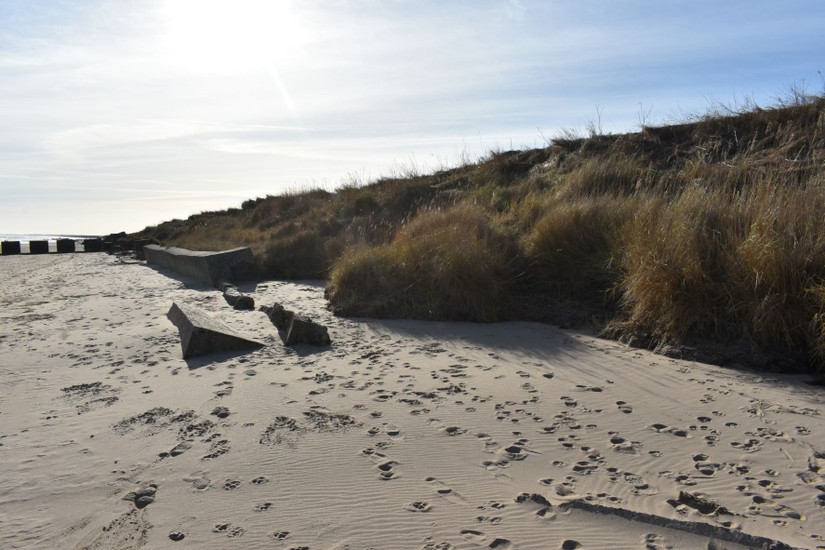
The two phases of anti-tank obstacle construction at Auburn were clearly represented in the surviving anti-tank blocks. The earlier anti-tank cubes built in 1940 were by and large constructed from a really poor concrete mix where sand had been used extensively to bulk out the concrete to make it go further. The use of this poor mix led to a distinctive concrete type on site that could be relatively easily identified as dating to July 1940. When compared to the anti-tank blocks constructed in March 1941 there was a clear difference. The second phase anti-tank blocks were built using a more standard and substantial concrete mix which has stood the test of time. Along with graffiti dates in the anti-tank blocks we are able to easily identify the two phases of defence construction on site.
By surveying and recording surviving sections of anti-tank block with the RTK and recording their date of construction we could build up a baseline of the wartime coast edge which would help us to assess the trends of erosion and visualise the wider picture. A photographic survey of the current coast edge, with photographs taken at set intervals was also undertaken to record the coastal environment at the time of survey. An additional aspect which we didn’t get around to doing was to take images to allow the creation of photogrammetry models of the coast edge at the time of survey. This could be well within the scope of future surveys where more time is available and could act as a decent visual record for future site analysis.
What did we learn?
Chris and Hannah set out joined by Maria, a student from the University of York, we spent several days at Auburn identifying, recording and surveying the wartime defences.
One of the first things we learned was how quickly the beach in this area changes. Each week the beach looked different, with accretion burying features and the cliff edge visibly changed and eroded within the space of a few days and weeks.
It became clear that there had been a significant amount of coastal loss at Auburn Sands, which appeared to start to the north of our favourite pillbox Earwig Villa.
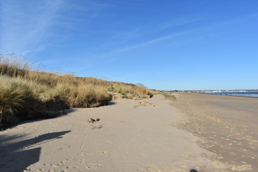
The change from sheer, freshly exposed bolder clay cliff face, to dunescape clearly represented the change from heavily eroding coastline, to secure and stable coast edge.
By analysing the survey results using GIS it became clear that this is likely the result of longshore drift caused by the direction of the North Sea tide and the way Flamborough Head juts out into the North Sea. Flamborough Head acts as a barrier (Thanks Tim!), shielding the area between the south end of Bridlington and Earwig Villa from the effects of longshore drift and storm activity. This means that the surviving defences are relatively safe from coastal erosion as there is little erosion of their vicinity. However, the defences are not safe from accretion and sand stripping caused by heavy swells. This answered the ‘Why is erosion limited to a specific area and why does it start so suddenly?’ question nicely.
On to the second question ‘What can we learn from surviving wartime coastal defences that can inform our understanding of trends of coastal erosion from 1940 to the present day?’.
By plotting the location of the defences using the RTK and analysing the results using GIS, we can measure the rate of loss of the coast edge over the course of 80 years. We can also use regressive mapping techniques to compare this erosion prior to 1940.
We can clearly see that erosion over the last 80 years has increased when compared to the 30 years before 1940.
So, we can visualise increased coastal erosion using the surviving defences as a benchmark, on this stretch of coast at the least. Increased erosion also appeared to be having a greater effect on specific areas of the coast, rather than affecting everything in a uniform fashion. This information could be used to identify areas which are more vulnerable to coastal erosion.
Finally, ‘can we use wartime defences as a benchmark to assess and understand coastal erosion?’.
Looking at the survey data it’s clear that surviving wartime defences can be used as a physical benchmark to assess coastal erosion. The implications of this are quite useful, especially in areas where extensive defences were constructed.
You can see our data below.
Conclusion
And there we have it. A new way of looking at wartime defences and a way of utilising them to understand and address future coastal erosion.
From this data we can estimate how much land has been lost in 80 years and assess the impact erosion is having on vulnerable coastal archaeology.
This method may very well be used in the future in the next version of CITiZAN.
You can find out more about the anti-invasion defences of Auburn Sands HERE
Sources
Dobinson, C. 1996. Twentieth Century Fortifications in England 2: Anti-Invasion Defences of WWII. Council for British Archaeology/English Heritage. Unpublished report.