CITiZAN data added to the Archaeological Data Service
24/04/2024 | Andy Sherman
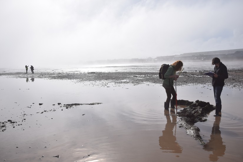
Since CITiZAN started way back in the spring of 2015 our team of dedicated and enthusiastic staff and volunteers have been adding new features to our interactive map, as well as monitoring sites that were already known to record any changes to them. In the eight years the project has been running we've recorded over 2,500 new features and surveyed the condition of known sites more than 5,000 times. All this information has now been archived with the Archaeological Data Service (ADS) in York, so our data can be investigated whenever anybody wants through the ADS's website. Nothing has changed with our website and you'll still be able to access all CITiZAN's information here, but it means our archive is now safely protected for the future.
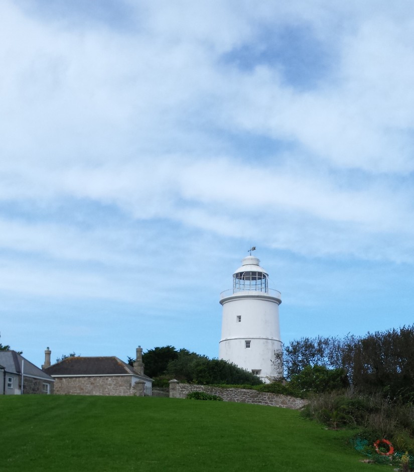
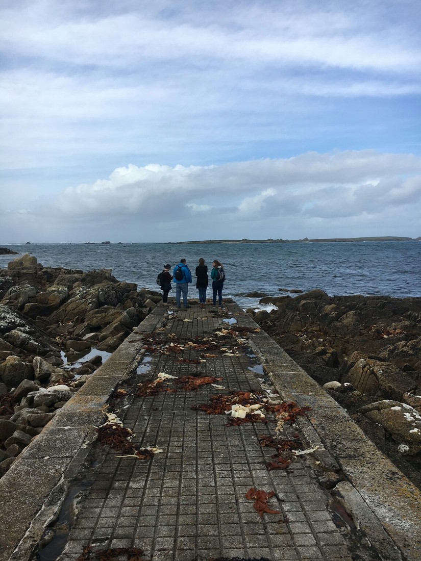
Our volunteers have recorded site from the top of England on both sides of the coast, to the very bottom of Cornwall and out to the Scilly Isles and the Farne Islands. The most southernly features that the team have recorded are the life-saving landscape that can be found around the island of St Agnes, which is four miles south of Lizard Point in Cornwall. The most visible part of that landscape, day and night, are the chain of lighthouses that ring the Scilly's warning ships of the dangers around them. The squat, white tower of St Anges's lighthouse is rare surviving example of a lighthouse which isn't light by a lamp. As the first light to shine out from the tower was a pile of burning coals held in an iron brazier, that was coaxed into life on 30th October 1680. Although built on the highest point of St Agnes, the lighthouse’s inland position hindered how far it could shine across the sea especially when the tower was wrapped in the frequent fogs which envelope the island. Because of this the light was replaced by a more modern light on Peninnis Head, the most southerly point of the main island, St Mary's, in 1911. While the lighthouse no longer warns passing ships of the dangers of the reefs around St Agnes it still acts as daymark, helping guide sailors safely into the sheltered waters of the Scilly Isles.
Some of our volunteers have even recorded features on the Scottish and Welsh coasts, while they've been on their holidays!
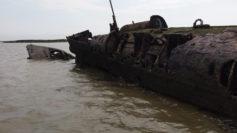
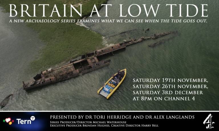
The most frequently visited feature on our interactive map is the remains of a surrendered, German U-boat form the First World War. The remains of this fearsome submarine were featured on the TV show, Britain at Low Tide and the data-spot for this metallic hulk has been viewed by members of the public over 1,000 times. Several candidates have been suggested for the remains of this sub, with the most persistently named being UB-122, which was commissioned into the Imperial German Navy on 4th March 1918 and surrendered to the Royal Navy in Harwich Harbour in November 1918. However, after being exhibited to the public at Southampton over Christmas naval records suggest that the UB-122 was scuttled in the English Channel in 1921, suggesting that these remains may instead be the last resting place of either the UB-144, UB-145 or UB-150. As well as being a TV star, the mystery of these remains true origins leads it to be CITiZAN’s most popular feature.
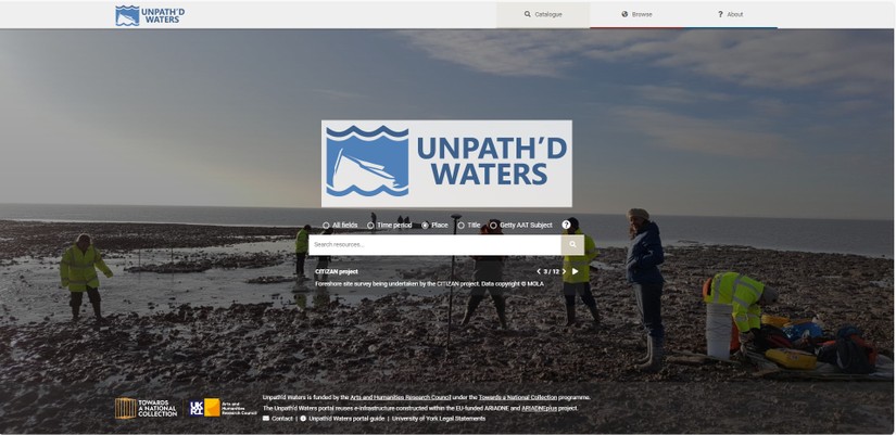
The archive is being uploaded to the Unpath'd Waters data portal. Through the portal you will be able to search our dataset by location and period as you can on CITiZAN's interactive map, but on the Unpath'd Waters portal you'll also be able to search via something called the Getty AAT Subject (Art and Architecture Thesaurus), this is an internationally recognised set of site types - so if historic swimming baths are your thing than you can search for all the swimming pools in our dataset.
We've also added the archives for two of our largest intertidal landscape surveys to the data stores at the ADS. The first archive is of an investigation into the erosion of the tobacco cliffs at Formby Point in Liverpool, carried out by CITiZAN's Team North since the autumn of 2015. (To read a little more about the history of the Formby coast read this blog.) While the second archive reflects one of the largest landscape survey's CITiZAN has carried out, when our East Kent Coast team recorded the huge number of fish traps which can be found across Sandwich Bay. (Read about one of our volunteers experiences carrying out this survey here.)
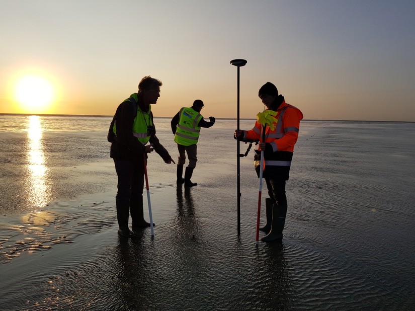
A huge thank you to all the volunteers that have helped us survey the archaeology of England's intertidal zone over the last eight years. This archive is a tribute to your dedication, enthuasiam and hardwork in all weathers around the country. Thank you one and all!
To search out data on the Unpath'd Waters portal click here.
To visit the various archives than click:
here for the main CITiZAN archive
here for the Sandwich Bay survey
here for the survey of the Tobacco Cliffs at Formby