Three Submerged Forests
25/08/2016 | Megan Clement and Lara Band
Submerged forests are perhaps one of the oldest examples of reported archaeological sites. There are records of submerged forests been seen since at least the 12th century, starting with Gerald of Wales in 1188, attributing submerged forests to God’s wrath and the remnants of the Great Flood. This was in fact Newgale submerged forest, re-exposed in 2014 after storms. Another example was recorded by Pepys in his diary entry on the 22nd September 1665, where he recounts a conversation with a shipbuilder, “that in digging his late Docke, he did 12 foot under ground find perfect trees over-covered with earth. Nut trees, with branches and the very nuts upon them; … And a yew tree he showed us … which upon cutting … we found to be rather harder than the living tree usually is.” This discovery was made at Blackwell and has been subsequent recorded by UCL and the Museum of London Archaeology, who recorded over 1500 trees.
The first comprehensive survey of these submerged forests on the English coastline was conducted by Clement Reid in 1913, a key piece of research in highlighting how important these prehistoric landscapes are. Since then many of these landscapes have been studied. CITiZAN have been working with professionals and local communities to record several submerged forests; in particular at Cleethorpes, Hightown and Pett Level.
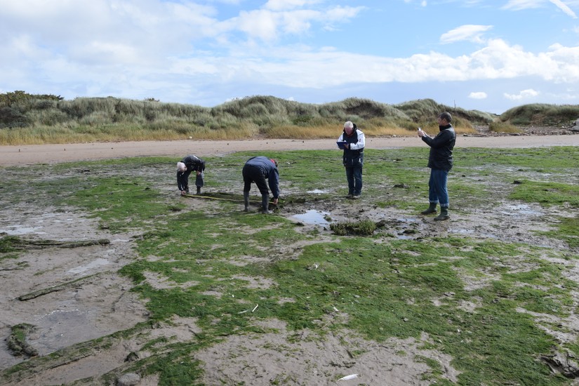
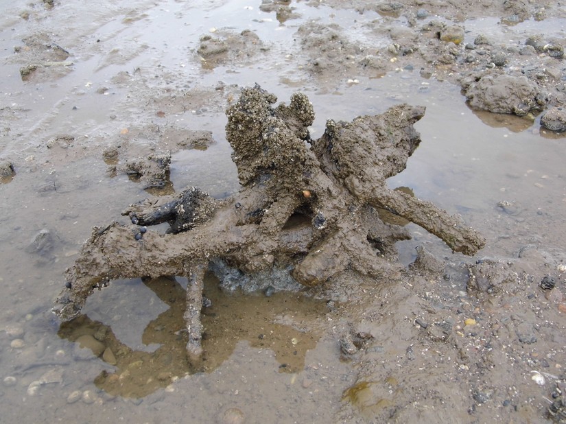
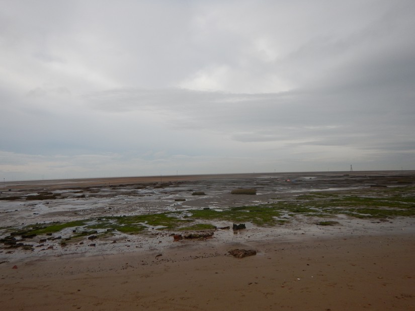
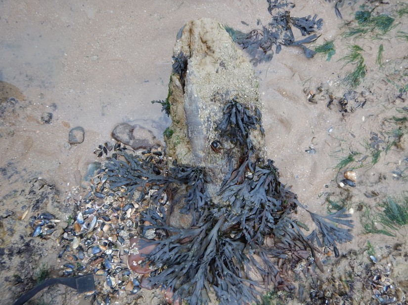
Cleethorpes has been a seaside resort for many years; starting in the early 19th century people flocked to this resort on the banks of the Humber for a day at the beach. However at the far end of the promenade there are indications of an environment which pre-dates the British seaside holiday by thousands of years. Venturing out into the intertidal zone, the remnants of a past landscape emerges as the tide goes out; revealing the remains of tree stumps and felled tree trunks, a prehistoric peat shelf and if you look very carefully wooden structures and flint implements.
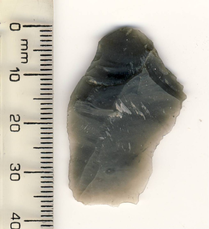
Very little is known about the submerged forest and only a small amount of research has been undertaken on the site. In 1979, a stone axe-hammer was found at the site by a local man digging for bait, realising what it was he brought it to the attention of the local museum. There was sufficient haft remaining to be able to scientifically date the axe-hammer, and a sample of one of the tree stumps was also taken for radiocarbon dating, along with a peat sample for paeolo-environmental analysis. The results concluded that the axe-hammer was intrusive, being Bronze Age in date, whilst the sample from tree stump was returned as Late Neolithic in date. The results of the peat sample suggested a dense oak forest, with no evidence of agriculture or a salt marsh environment. Further samples from the preserved trees were taken for radiocarbon dating by Historic England in 2013, which returned a Late Neolithic date. However no further work was done on the site, until 2015 when CITiZAN visited.
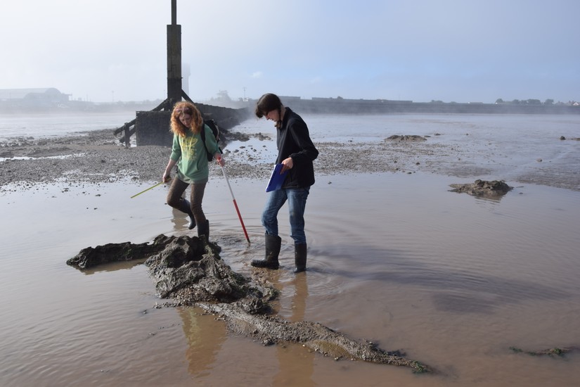
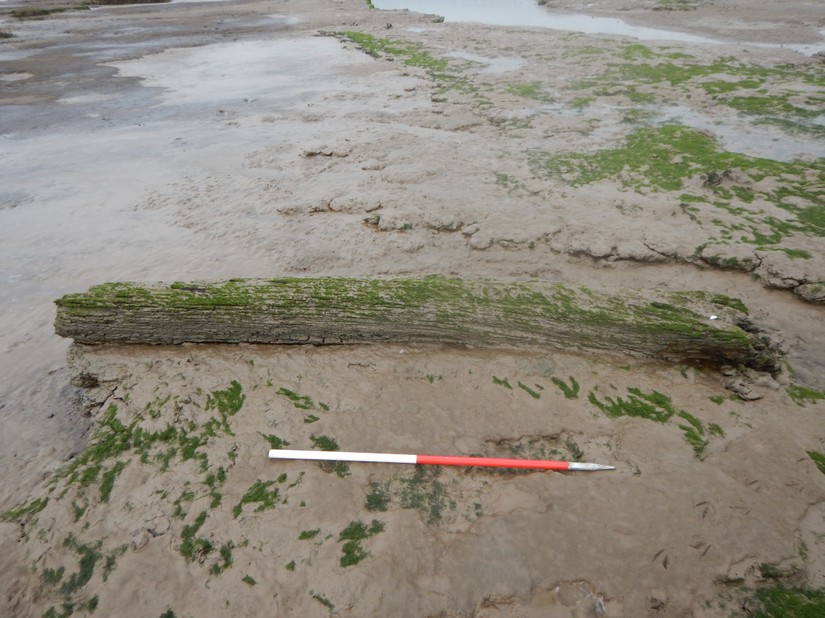
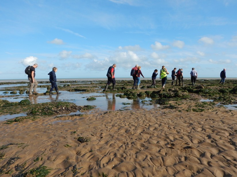
Since 2015 CITiZAN have been returning frequently to the site with a group of volunteers, including locals and Duke of Edinburgh volunteers, to record the spatial distribution of the trees, the erosion of the peat shelf and monitor the discovery of a prehistoric structure which has been interpreted as a trackway, that was found eroding out of the peat shelf. A sample of the trackway was taken for analysis; its species was confirmed as oak and radiocarbon dating will be done on it. The timbers used within the structure of the trackway suggests that they are from an unmanaged woodland.
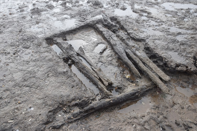
Taking into account the evidence complied by the analysis done after the recovery of the axe-hammer, it is curious to find a trackway, which suggests a marshy fencar environment, in a dense and unmanaged woodland. Further investigations this September will focus on mapping the submerged forest, monitoring the trackway and the rate of erosion of the peat shelf there.
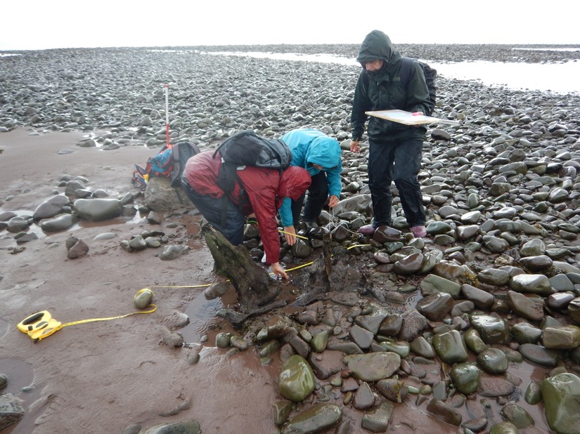
On the west coast, just north of Liverpool on the Sefton shoreline a different situation presents itself. On a quiet unused part of the foreshore, close to Hightown and the mouth of the River Alt, is another submerged forest. This submerged forest has been known about since it was uncovered by the sea in the 1870s. It has had quite a bit of research done on it with species analysis carried out on the exposed trees in the same decade it was uncovered. A PhD student in the 90s did some further paeolo-environmental analysis on the site. He identified the dominant species present as being birch, with smaller amounts of oak, alder and willow also present. It has been suggested that, like Cleethorpes the woodland was unlikely to have been managed and only likely used as a wild food resource.
There is also a peat shelf situated close to the mouth of the Alt, which has and still is suffering from erosion by the sea. Part of the peat shelf has now been over-covered by rubble dumped there after the Liverpool Blitz. In 1996 a trackway was discovered eroding out of the peat and was radiocarbon dated as being Early Neolithic. It was thought to have been constructed as access to a saltmarsh in the intertidal zone, and possibly used for fishing or access to vessels.
CITiZAN will be at the Hightown submerged forest this September to do some monitoring work here, to see what effect the erosion is having on the submerged prehistoric landscape.
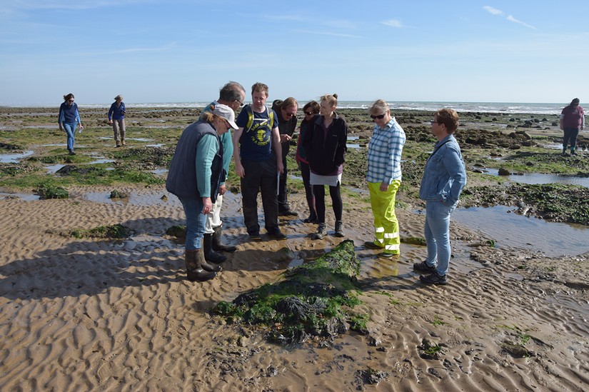
The beach at Pett Levels is a particularly picturesque part of the East Sussex foreshore and a popular day trip destination. But it has a secret hidden in plain sight: the Pett Level submerged forest. On the intertidal peats, to the south of Pett Village, the trunks, branches and roots of prehsitoric woodland are scattered along the foreshore, beneath the sandstone cliffs of Cliff End. In the early 20th century several Mesolithic flint artefacts were found in a cave nearby, which overlooks the site. An excavation within the cave in 1972 failed to recover further artefacts; though during the excavations a member of the public discovered an unabraded Mesolithic type blade core in the mud at low tide. Providing evidece for a probable Mesolithic presence in the area.
The peats and submerged forest were recorded in the early 20th century by Clement Reid, but only a very limited amount of study had been carried out since; until 2014 when Dr Timpany of the University of the Highlands and Islands, instigated an English Heritage funded community archaeology project to assess the nature and extent of the forest. With a team of volunteers he collected tree samples for identification and dendrochronology and peat samples for pollen, plant and insect analysis. The CITiZAN South East team organized a return to the site in 2015 with Dr Timpany and with a team of volunteers both new and old, recorded and sampled another section of the forest, recording and sampling over 50 more trees. This July, for a Historic England project, Dr Zoë Hazell and her team carried out a survey of the site with a Small Unmanned Aircraft to assess the use of aerial photography for mapping intertidal peats and submerged forests.
Dr Timpany’s interim analysis of the upper peats and the trees at Pett Level has conjured up a vibrant picture of the Late Neolithic- Early Bronze Age forest. At first this was damp woodland predominantly covered with alder though also including willow, ash, birch and oak. Trees such as pine, lime, elm, hazel, oak and hawthorn grew in drier surrounding areas, including the cliff top at Cliff End. Pools of water lay on the wet woodland floor, with a ground cover of fool’s-water-cress, water avens, greater spearwort and water-pepper, pond weeds, common bulrush, lesser marshwort, sedges and cowbane. Layers in the peat suggest a period of inundation however; the woodland died back and saltmarsh with goosefoots, daisies, chamomiles and grasses developed.
Following this a more mixed woodland developed. Trees and shrubs included alder buckthorn, yew, ash, willow, birch, hazel and possibly guelder rose, with trees such as elm, pine, lime, wayfaring tree, holly and whitebeam on top of the cliff. The woodland floor was still damp but dominated by brambles with meadow rue and sedges, bedstraws and marsh marigold. Evidence of branches lower down on the tree remains indicates they had space to grow out horizontally as well vertically suggesting patches of open woodland within the forest. Denser patches of woodland still existed however: numerous trunks contained no branches and grew to great heights to reach the canopy space; alder and ash trees of up to 10-11metre were recorded. During this period there is even evidence for a storm event: a peak in deadwood fungi types indicates an increase in fallen branches and rotting wood on the woodland floor.
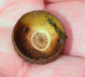
A gnawed hazelnut suggests the presence of wood mice while remains of dung related beetles found in the peat suggest that animals larger than the mouse also roamed this woodland. The presence of charcoal suggests local evidence for burning of the wetland, perhaps anthropogenic in nature and for woodland management purposes.
To visualise the Early Bronze Age woodland Dr Timpany worked with graphic artist Alice Watterson on a reconstruction drawing of the woodscape at Pett Level. This shows both the dense and more open tree cover, the wet woodland floor with shallow open pools of water along with ferns, clumps of sedges and brambles. A stag, representing the evidence of the larger grazing animals stands in a clearing. Drier woodland sits on top of the face of the cliff at Cliff End, still recognisable today.
Events
On the 23-25th September the South East team will be back at Pett Level to record another section of the forest with Dr Timpany; we’ll also be joined Dr Hazell so it will be a great opportunity to learn more about this fascinating site from two experts. There’s still some places left!
On the 24th and 25th September the North team will be at Hightown undertaking some non-intrusive investigation of the site to help establish the erosion effect there on the submerged landscape with volunteers.
During the heritage weekend there is the opportunity to learn more on the 10th September at the town hall as two talks will be given at 11am and 2pm on the submerged prehistoric landscape of Lincolnshire. In addition keep an eye out for more upcoming guided walks of the site. Dates in late September will be released for further opportunities for training on the site.
On the 30th of September the South West team along with staff from the Exmoor National Park will be exploring the preshitoric landscape of Porlock Wier and planning the submerged forest locatated there.
Check out the events page for more info on these upcoming opportunities! Search the interactive map for more infomation on what has been found at these sites.