Frequently Asked Questions
The Coastal and Intertidal Zone Archaeology Network (CITiZAN) answer frequently asked questions to help inquisitive and intrepid coastal explorers.
Volunteering with us:
1. How can I hear more about the project?
A: Each regional team sends out a monthly e-newsletter with updates on exciting new discoveries and upcoming events in your area. To register, sign up to your preferred regional newsletter. You can join any regional mailing list you like, or sign up to all three! Once our newly funded project is fully set up these will be sent out again.
Return to top
2. Is there a required time commitment to volunteering with CITiZAN?
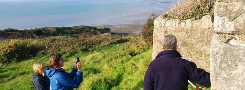
A: No, there is no set time commitment to volunteering with us! We welcome you to spend as much or as little time monitoring the coast and intertidal zone with us on as you can: by using our free smart phone app CITiZAN coastal archaeology survey, by coming along to one of our fieldwork events or by joining a local monitoring group.
Return to top
3. I would like to volunteer! Can I register my interest?
A: Of course! Once the new project being established is fully up and running we will be running Training and Outreach events open to volunteers. You can attend a CITiZAN event to learn more about the project and try some hands-on archaeological surveying. You can also download our smart phone app to record and monitor archaeology on the go!
Return to top
4. Can I still monitor coastal heritage features if I don’t have a smart phone?
A: All of our feature recording forms and update survey forms are available to download and printout to take with you while you explore England’s foreshore and coastline. For PDF copies of our recording forms, visit our Resources page. Please read the step-by-step guidance “How to submit a feature update survey” for more information on how to download feature update survey forms and also consult FAQ #15 below.
Return to top
Out and about:
5. What should I do before I go out on a monitoring visit?
A: Always check the tide times in advance and give plenty of time to get off intertidal sites as the tide comes in faster than it goes out. Be aware of dangerous spots (quicksand, sticky mud, pinch points, etc.) and keep an eye out for signage and flags. Know your grid reference location; you can get this through the CITiZAN smart phone app when you add a new feature or on Google maps. Bring a fully charged mobile phone with you and call 999 and ask for the coast guard if you need assistance.
You should attend a training session for in-depth information about coastal heritage and how to monitor it before adopting a portion of the coast. Adhere to the CITiZAN policies: for more information please consult the volunteer code of conduct, health and safety and finds policies.
Return to top
6. What dangers should I look out for?
A: The coast and estuaries are dynamic and sometimes dangerous landscapes. Be aware of the tides and currents, sticking or sinking muds and sands, or pollution. Always wash your hands after your visit before smoking or eating. Keep an eye out for munitions having washed up on the beach and flares; if you see any cylindrical metalic objects do not touch them! Always bring a fully charged mobile phone with you and call 999 and ask for the coast guard if you need assistance. please consult the volunteer code of conduct and health and safety policies for more information.
Return to top
7. How do I check and read tide times?
A: All coasts and estuaries are different and a good low tide height in one part of the country could be dangerous in another. Investigate which tide heights are good for your particular area. There are many informative websites which provide tide times. Search for your nearest port. The tide times tables should say the height of the high and low tides for the day in meters and the time these will occur. Be aware that some sites provide high and low tide times in GMT; if you are visiting the foreshore in British Summer Time (BST) please add 1 hour.
- http://www.bbc.co.uk/weather/coast_and_sea/tide_tables
- http://www.ukho.gov.uk/Easytide/easytide/SelectPort.aspx
- http://www.metoffice.gov.uk/public/weather/tide-times/
- https://www.tidetimes.co.uk/
Return to top
8. What do I do if I find artefacts?
A: Artefacts and chance finds should be reported to your local Finds Liason Officer. You can also record finds using the Marine Antiquities Scheme app. Treasure must be reported to the coroner within 14 days. Wreck items must be reported to the Receiver of Wreck within 28 days. Reporting treasure and wreck material will require filing out paperwork, which your FLO and CITiZAN archaeologists can assist you with. CITiZAN cannot collect artefacts ourselves but will guide you to the best destination for any finds. Please consult our finds policy for more information.
Return to top
9. What if I think I have found human remains (bones, burials, cremation remains)?
A: You must report all suspected human remains to the police immediately, even if you think that they are from antiquity (e.g. a Bronze Age burial) and also your regional CITiZAN archaeologists. Please do not excavate the remains as this may remove valuable information about the site and the burial itself. If it is threatened by the tide and going to float away, retain the bone and alert the authorities and CITiZAN immediately.
Return to top
Monitoring the English coast with the interactive coastal map:
10. Do I need to register to use the interactive coastal map?
A: Not necessarily. You can explore the interactive coastal map without having to register. If you would like to edit or add features, provide update surveys, or use our smart phone app you will need to register as a CITiZAN surveyor. Please note, this is a three-step process! Please read the step-by-step guidance “How to register to be a CITiZAN surveyor” for more information.
Return to top
11. How can I explore the interactive coastal map?
A: The interactive coastal map is based on Bing and Google maps and so you explore it in much the same way as you would with those maps. You do not need to be registered as a CITiZAN surveyor to explore the map on the website. Please read the step-by-step guidance “How to explore the interactive coastal map” for more information.
Return to top
12. I have spotted a new heritage feature on the coast or intertidal zone! Can I add a new feature to the interactive coastal map?
A: Yes! The CITiZAN network of volunteers is adding more information on coastal heritage all the time. Scroll below the interactive coastal map and click the “Add feature” button. Please read the step-by-step guidance “How to add a new CITiZAN feature” for more information. You must be a registered CITiZAN surveyor and be logged in to the CITiZAN website.
Return to top
13. Can I edit a feature on the interactive coastal map?
A: Yes! There are going to be gaps in data in some of these records mainly due to the availability of data when we created our baseline database. Where gaps do exist please feel free to add information where you are able. If you find typos or a lack of information, e.g. where a site name is not very descriptive, you can update these to make the record more useful. Select the feature you want to edit, scroll down and click the orange link to “edit the original record”. Please read the step-by-step guidance “How to edit a CITiZAN feature” for more information. You must be a registered CITiZAN surveyor and be logged in to the CITiZAN website.
Return to top
14. I have visited a feature on the interactive map and have taken photos of it. How do I submit the information?
A: You can submit an update survey for the feature. Select the feature you have surveyed, scroll down and click the orange link to “submit your ‘Feature Update Survey’”. Please read the step-by-step guidance “How to submit a feature update survey” for more information. You must be a registered CITiZAN surveyor and be logged in to the CITiZAN website.
Return to top
15. Do you have an update survey form I can print out and take with me on site?
A: Yes, you can download and print copies of update survey forms for each feature you think you will encounter. Select the feature you think you will survey, scroll down and click the orange link to “prepare a 'Feature Update Survey' pack for this feature (in PDF format)”. The PDF will open in a new window. You can print this and take it with you to annotate in the field. You can input this information into the CITiZAN interactive coastal map by submitting a feature update survey. Please read the step-by-step guidance “How to submit a feature update survey”; for more information and also consult FAQ #14 above. You must be a registered CITiZAN surveyor and be logged in to the CITiZAN website.
Return to top
16. Can I see what features and survey data I have submitted to the interactive coastal map or CITiZAN smart phone app?
A: Yes, you can access this information by logging in to your account on http://www.citizan.org.uk/. Click “Your records” at the top right hand side of the window to see a list of your Edits, Images, Features and Feature update surveys. Any of these that are marked as Pending have not yet been moderated and can still be edited by you. Any of these that are marked as Published are live on the interactive map! You can access the feature form by clicking on a feature or feature update.
Return to top
17. Why is my new feature or feature update survey marked as Pending?
A: All of the new feature or feature update survey information goes through moderation by one of our CITiZAN archaeologists before it is made live on the interactive map and CITiZAN smart phone app. Data moderation is carried out on a bi-weekly basis when the project is actively running. If you can’t see your update or photos on the feature form yet please do check back later.
Return to top
Monitoring on the go with the smart phone app:
18. Where can I download the CITiZAN smart phone app?
A: Our smart phone app CITiZAN coastal archaeology survey is available for Android phones and tablets in the Google Play store and Apple phones and ipads in the App store
Return to top
19. How much does the app cost?
A: Our smart phone app CITiZAN coastal archaeology survey is free to download! There are no additional in-app costs either.
Return to top
20. How can I register to use the CITiZAN smart phone app?
A: You can register as a CITiZAN surveyor here. Be aware, this is a multi-step process! You will need to activate your account by clicking the link in your email. You will then have to supply further information before becoming a full CITiZAN surveyor. Do this by following the orange “become a CITiZAN surveyor” link in your CITiZAN account. Please read the step-by-step guidance for more information.
Return to top
21. I am already registered to use the interactive coastal map. Do I need to register again to use the CITiZAN smart phone app?
A: No, you can use the same user name and password to access the CITiZAN smart phone app.
Return to top
22. How do I use the CITiZAN smart phone app?
A: Our app can be used to explore what coastal and intertidal heritage is already known, to add new features as they are discovered, and to provide regular update surveys of these. This can be done by providing a GPS location, photos, and text about an archaeological feature. Please read the step-by-step guidance “How to use the CITiZAN app”, “How to add a new CITiZAN feature” and “How to submit a feature update survey” for more information.
Return to top
23. The mobile reception near me is patchy. Will the CITiZAN smart phone app still work?
A: Yes, the CITiZAN coastal archaeology survey app is designed to work offline. However, our app does require an internet connection in order to first log in and later upload survey forms. We recommend that you download the forms of features you expect to encounter before setting off using Wi-Fi at home or a nearby café or pub. The forms can be saved to your device in the field and uploaded when you have access to Wi-Fi again. Please be aware that if you do not download and upload forms using Wi-Fi, you will be relying on your mobile data which will affect your usage and may incur additional charges on your bill. Please read the step-by-step guidance “How to use the CITiZAN app” for more information.
Return to top
24. I can’t find any of the associated feature update surveys or pictures when exploring CITiZAN features on the map in the app; why?
A: The CITiZAN coastal archaeology survey app is a pared down version of our interactive coastal map. In order for the map to load without being overwhelmed, certain tools and properties available on the website version have been removed, such as: different colours for new and baseline CITiZAN features, accessing feature update surveys and photos.
Return to top
25. On the interactive coastal map, new features are marked with green points. Why are all points the same colour on the app?
A: The CITiZAN coastal archaeology survey app is a pared down version of our interactive coastal map. In order for the map to load without being overwhelmed, certain tools and properties available on the website version have been removed, such as: different colours for new and baseline CITiZAN features, accessing feature update surveys and photos.
Return to top
Smart phone app not working? Troubleshooting:
26. I have already registered but I cannot update any points on the app; why?
A: Registering as a CITiZAN surveyor is a three-step process. After registering online, you will need to activate your account by clicking the link in your email. You then have to supply further information before becoming a full CITiZAN surveyor. Do this by following the orange “become a CITiZAN surveyor” link in your CITiZAN account. Please read the step-by-step guidance for more information.
Return to top
27. I have registered but I cannot log in on my phone or tablet! How can I log in?
A: The CITiZAN coastal archaeology survey app is designed to work offline, however, it does require an internet connection in order to log in. Ensure you device is connected to the internet via mobile data or Wi-Fi in order to log in.
Return to top
28. I have forgotten my password! Can I reset it?
A: Yes, you can change your password by visiting this link or on the app by clicking the link “Forgotton your password?” on the log in screen. When prompted, enter your registered email address into the box and look out for an email from CITiZAN in your inbox and follow the instructions. Be sure to check your junk or clutter folders.
Return to top
29. I am using my phone or tablet to explore the interactive coastal map on your website and I cannot see any points; why?
A: The website version of the CITiZAN interactive coastal map contains over 80,000 points and many map layers to help explore the features and their surroundings. This is a lot of information for a phone to process via mobile data or Wi-Fi and this results in showing you a map with no points. If you would like to explore the CITiZAN map and record and monitor coastal features, you will need to use the smart phone app CITiZAN coastal archaeology survey.
Return to top
30. I don’t have an Apple or Android phone (e.g. a Nokia Lumia or other Windows phone, Blackberry, etc.) – can I use the app on my device?
A: Currently our smart phone app CITiZAN coastal archaeology survey is only available for Apple or Android devices.
Return to top
31. I do have an Apple or Android device but the app isn’t working; why?
A: This could be due to your device’s operating system. In order to run, the CITiZAN coastal archaeology survey app requires an operating system of Android v.4.0.3 and later or Apple iOS v.7.0 or later. Please check your operating system is up to date.
Return to top
32. My ipod touch operating system is up to date but the app isn’t working; why?
A: This could be due to your device’s location services being deactivated. In order to run, the CITiZAN coastal archaeology survey app requires access to a GPS location. If this is disabled on your ipod touch, the app will not work on this device.
Return to top