From Prehistoric Footprints to the First Lifeboat Station
28/01/2016 | Andy Sherman
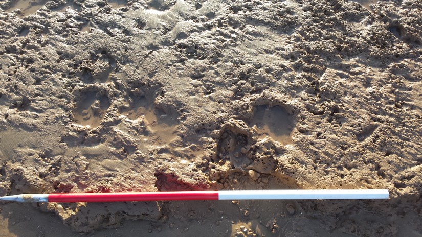
Formby Point is located on the shores of Liverpool Bay approximately six miles north of the River Mersey and is a long sweep of beach, backed by sand dunes and coastal pinewoods. During the Neolithic period, 7000 years ago, the area didn’t look like it does today. A large sand bar had formed about a kilometre out into the bay which impeded the flow of water from rivers and streams into the sea, forming a muddy salt-marsh fringed by a fen carr. (An area of small islands of oak and alder separated by shallow pools of brackish water.) Family groups’ hunted deer and wild boar around the edge of the marsh leaving their foot prints in the mud. These prints from both humans and animals can still be seen today and include auroch (an extinct species of cow that was six foot tall at the shoulder), red deer, roe deer, wild boar, wolf, oyster catcher and crane. The salt marsh would have been an important landscape for the local population enabling them to not only hunt, fish and fowl but also collect eggs, shell fish, seaweed and many other resources. The human footprints preserved in the prehistoric mud include those of adults and young children. Once the prints had been left in the mud some of them were baked hard by the sun and then filled by windblown sand, which were then covered by another layer of mud sealing the footprints until they were uncovered by the sea thousands of years later (Burns 2014).
A short distance down the coast at Hightown a 60m length of wooden trackway was uncovered in 1996. The best preserved section of the trackway was approximately 1.5m wide and roughly 0.30m deep and was made up of three distinct layers. The lowest part of the trackway was constructed from hurdle panels, which were overlain at intervals by occasional pieces of wider, flatter timbers that included oak and elm and occasional roots. Above these timbers was a closely packed deposit of small branches, some which had been inserted vertically through the trackway to provide support to the structure. The trackway was radiocarbon dated to between 3795 BC to 3675BC and would have been used by the local population to travel around the wetter areas of the fen carr (HER number: MME1074).
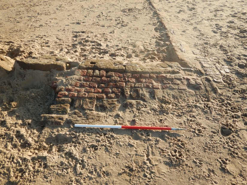
The sea level in Liverpool Bay continued to raise until it reached the same height as today about 350 years ago (Burns 2014). By the time this happened Liverpool had become a bustling port frequent by ships from across Europe and beyond. However, the Bay was extremely dangerous with treacherous currents and frequently shifting channels of deep water that caused innumerable boats to be wrecked and sailors to be drowned. This led the Trustees of Liverpool Dock to establish Britain’s first known lifeboat station at Formby Point. The exact construction date of the building is unknown but a footnote to ‘A chart of the Harbour of Liverpool’ drawn in 1771 and corrected in 1776 provides the first documentary evidence for a ‘boat and station for the saving of lives’. In 1777 a sailor called Richard Scarisbrick was appointed to take care of the boat and boathouses erected to protect it with a salary of two guineas a year (Yorke and Yorke 1982). The boathouse was repaired or rebuilt several times between 1793 and 1809, before closing in 1888 but reopened four years later before finally closing in 1918. The building was reopened as a café a short while later till the 1950s, when the building was demolished. Today the sand stone and brick foundations can be seen protruding from the beach’s sand.
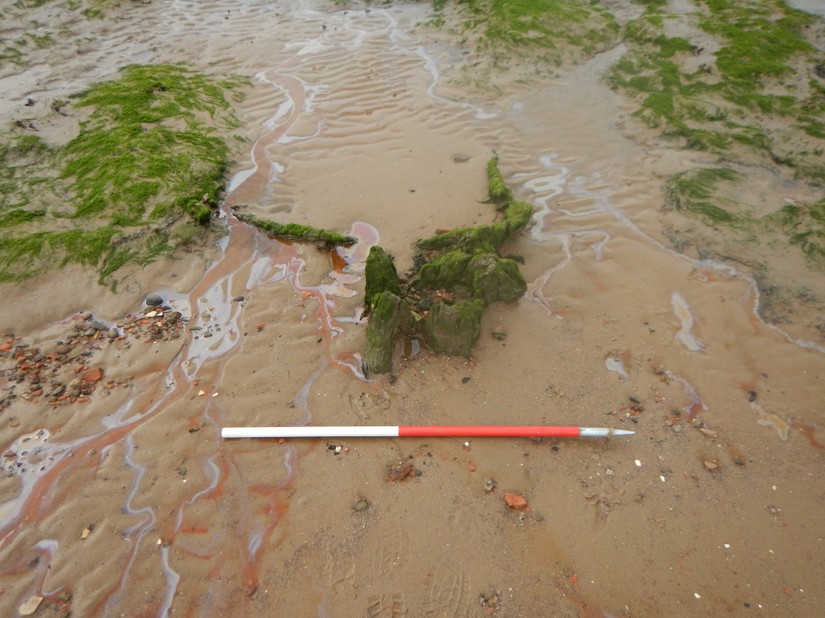
Liverpool Docks was at its busiest during the late-19th and early-20th centuries when thousands of tons of cargo was shipped through the port, including large quantities of tobacco. From 1956 to 1974 the British Nicotine Company dumped significant quantities of waste tobacco leaves at Formby, up 22,000 tons a year. The tobacco was dumped on abandoned asparagus fields and today the sea has reached the dumping ground spilling lumps of tobacco across the beach (Millington et al 2010).
If you'd like to find out more, come along on one of our events or sign up to be an online CITiZAN surveyor and use our smartphone app to record England's coastal heritage.
References:
Burns A, 2014, The prehistoric footprints at Formby
Millington J, Booth C, Fullen M, Trueman IC, Worsley A, Richardson N, Newton M, Lymbery G, Wisse P, and Brockbank A, 2010, Effects of tobacco waste tipping on the Sefton coastal dunes (North-West England). Proceedings of the Green Conference, Vilnius, Lithuania 1st - 4th July, 2008
Yorke B and Yorke R, 1982, Britain’s first lifeboat station, Formby, 1776-1918