Rapid recording on Roa (Barrow-in-Furness)
04/08/2017 | Megan Clement
As part of the Festival of British Archaeology, CITiZAN were very busy, with 11 events over the two week period! Several of these vents were based around using the CITiZAN smart phone app; including an event undertaken at Roa Island in Morecmabe Bay with Headland to Headspace and the Morecambe Bay Partnership.
Roa Island is a small island, now permanently connected to the mainland by a causeway about a mile in length, close to Barrow-in-Furness in Cumbria. If you want to catch the ferry over to Piel Island off the coast, you take it from the southern tip of Roa Island. Approximately 100 people live on the island.

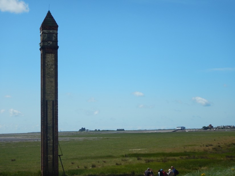
Our guided walk started, not on Roa but on mainland at Rampside where the causeway to Roa Island starts. The main reason for stopping here was to record Rampside Navigation Light (82673), also known locally as “The Needle”. The beautiful building is Grade II listed, built of red and yellow brick and approximately 20m in height. It was built c.1875 and known as No.4 leading light, the only one of 13 now still surviving. It would have been used by sailors trying to bring their boast in the port of Barrow safely. There were similar lights built on Walney Island and Foulney Island, but unfortunately these no longer survive.
Once recorded we moved on down the causeway, stopping halfway where the causeway plits. Carry on along the road and you reach Roa but if you make a left you can walk out to Foulney Island, looked after by the Cumbria Wildlife Trust and is a haven for many of Morecambe Bays birds. If you step out on to the small bay which has formed midway down the causeway, it look very much like a ship and boat graveyard. With at least 5 boats and ship in varying degrees of decay.
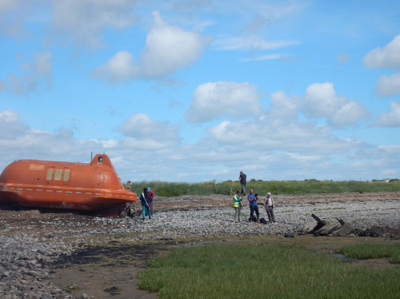
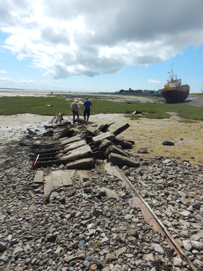
The most noticeable of these were the remains of a large orange lifeboat (82683), the type which can be found on oil rigs and a huge iron trawler, both of which had been seemingly anchored and left here. Less obviously there was the more interesting remains of a 20th century wooden vessel (82684), with the remains of concrete ballast. The remains of the wooden ribs, keel and keelson could all be seen. Further up the beach was the remains of a stern post and rudder (82678), though it is unknown if this belongs to this 20th century wreck. Scattered around elsewhere were numerous wooden and fibreglass boast of a much smaller nature which had been abandoned here.
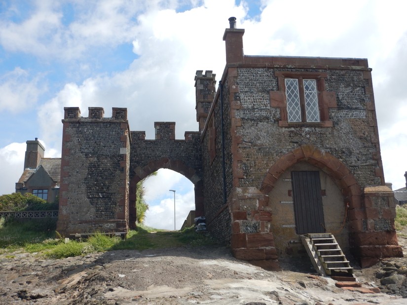
Continuing on down the causeway and on to Roa Island proper, you pass a boat club and can take left down onto the foreshore there. As you emerge onto the foreshore you will have passed through an archway of the old watchtower (37526). This magnificent looking building was built in c.1847 as a look out post for Customs and Excise. The building is Grade II listed and was constructed out of sandstone with chevron arranged beach peddle creating and unusual decoration. There had been a customs house overlooking the Piel Channel until 1760, when it moved to Ulverston, only to return in 1849. Now closed up, there was once an entrance to a boathouse in the lower part of the building.
From the foreshore here you can see the slipway used by the boating club clearly. Venture further towards the seaward site of it, however, another lesser known feature comes into view. Most locals are familiar with the old Peel Pier. In 1840, a banker from London, John Able Smith, bought Roa Island and built a causeway; until 1840, Roa Island had been as island, only accessible by boat at high tide or foot at low tide. Smith completed his causeway and pier in 1846 and doing a deal with Furness Railway, connected rail and sea. From there steamers were chartered to Fleetwood and then from 1867 to Belfast in Northern Island and Douglas on the Isle of Man. In 1891 the pier closed, due to the change in the deep water channel and the pier was dismantled and taken to Grange and partially re-erected.
After some searching, the remains of three columns of timber arranged in approximately 9 rows (82682), protruding southwards from the boat club slipway. This alignment was not the same as the Peel Pier when looking at old maps. However, a map from 1849 does show another arm protruding off the Peel Pier on the same alignment as this row of timbers. Could this be part of the Peel Pier?
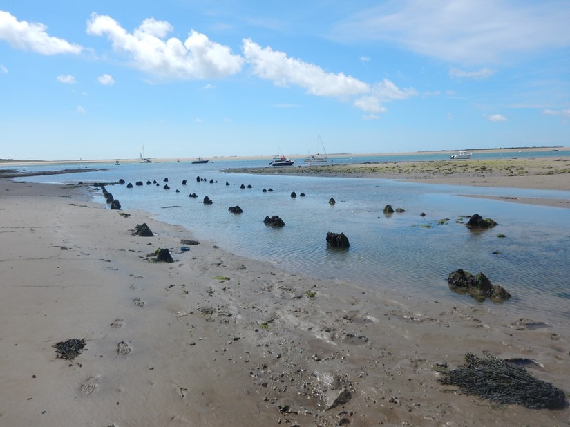
Continuing on the way, heading southwards to the bottom on the Island, where the slipway for the current ferry over to Piel Island lands. Although there are aerial photographs which suggest both the remains of a pillbox and a coastal battery were here, these feature have unfortunately disappeared. What was present, however, were the remains of another jetty (82679). Arranged in groups of three, there were four rows of these. The current coastal defences, a concrete seawall, were in fact built around the upper most of these timbers. Perhaps this was a pre-cursor to the new Piel ferry jetty.
This concluded our rapid recording on Roa, hopefully we will be back soon to do a bit more! Thanks to all the volunteers who helped us out.
Bibliogrpahy
For the Historic England records for the Rampside Navigation Light and the Watchtower
https://historicengland.org.uk/listing/the-list/list-entry/1197853
https://historicengland.org.uk/listing/the-list/list-entry/1218986
For more info on the watchtower
http://www.bbc.co.uk/history/domesday/dblock/GB-320000-462000/page/5
To see artists drawings of the Pier Pier
http://www.gracesguide.co.uk/Piel_Pier
http://www.geog.port.ac.uk/webmap/thelakes/html/lgaz/gb05e5.htm


