CITiZAN at Hest Bank and Ulverston
30/03/2017 | Henry Weeds (University of York placement student)
In addition to a significant community archaeology programme, CITiZAN also has a number of research goals it works towards. It conducts its work within the Regional Research Framework for the North-West. Before we get into the kind of sites CITiZAN work on, it is important to understand CITiZAN’s regional research agendas for the North-West.
The Regional Research Framework exists to aid regional museums and research groups to fill gaps in local knowledge, particularly when certain historical periods are lacking in detail. For the north west of England, this encompasses: Cheshire, Cumbria, Lancashire and the boroughs of Greater Manchester and Merseyside. The strategy sets out “priorities and proposals for delivery of future research, work programmes and changes in working practice to promote research objectives” (Chitty & Brennand 2007: 7). The north-west is unique among English counties in that it borders Wales and Scotland, creating a geographically diverse landscape. One of the Regional Research Framework’s initiatives involves greater collaboration between the counties and countries the north-west borders as well as situating the archaeology of the north-west within its wider context of the Irish Sea.
This absence of sufficient archaeological investigations has “perpetuated the myth” that the region, until the later medieval period, was culturally and materially poor despite environmental investigation suggesting otherwise. Given the north-west’s maritime and naval history, further investigation into post-medieval archaeology has become an increasing priority as many sites begin to erode (Chitty & Brennand 2007: 21). For example, a survey of medieval and post-medieval fishing sites in England “did not mention a single site from the North west” though it’s clear from other sites in England that fish was a vital part of the diet and a number of communities of this time would grow into significant settlements (Newman & McNeil 2007: 119). Fishing weirs on rivers, could lead to the creation of artificial islands as evidenced at Corby but these have had little investigation. The coastal fishing industry is clearly in evidence through preserved fish traps in the intertidal zone at Morecambe Bay but more through research, as CITiZAN are conducting, is in need of more data. The Regional Research Framework has established two initiatives to be examined further:
i. “Examine and map pre-18th century enclosure across the region using the county HLCs as a starting point.”
ii. “All post-medieval deposits should be targeted for the systematic recovery of shellfish remains and fish bones. They require analysis to record size, shape and parasitic infestations in order to establish location of sources and any seasonality of harvesting.” (Newman & McNeil 2007: 119)
Britain was the world’s first industrial superpower, and the north-west was its spearhead but there has been little significant coastal research in these areas despite the potentially enormous reward of information. The architecture around Liverpool’s dock area attests to its maritime and industrial power, hence its epithet as the second city of the British Empire and its current World Heritage Site listing. However, research into the intertidal zone is sorely lacking, a factor which CITiZAN is remedying with its work at Formby beach which has Britain’s first purpose built lifeboat station. The Liverpool bay area also has a “phenomenal concentration of likely wreck sites”. The same is true of the Morecambe Bay area which “is littered with the remnants of wooden jetties, wharfs, fish traps and fishing baulks, the majority of which are likely to date to the 18th to 20th centuries” (Newman & McNeil 2007: 141). They also represent the “remnants of living history” such as the continuing tradition of haff netting to catch salmon in the Solway area and also on the Mersey estuary areas.
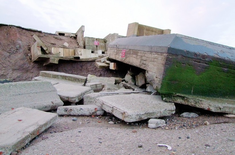
The 20th century was also characterised by a significant costal fortification programme in light of the First and Second World War and emplacements in the cold war period. This level of fortification had not been seen since the late Roman period and as such, much work has been conducted to identify survey and record these sites. Due to coastal erosion, sites such as the Bridlington pillboxes have collapsed and the Godwin coastal gun battery in Easington, North Yorkshire, has slid off the cliffs it was built on (Newman & McNeil 2007: 157).
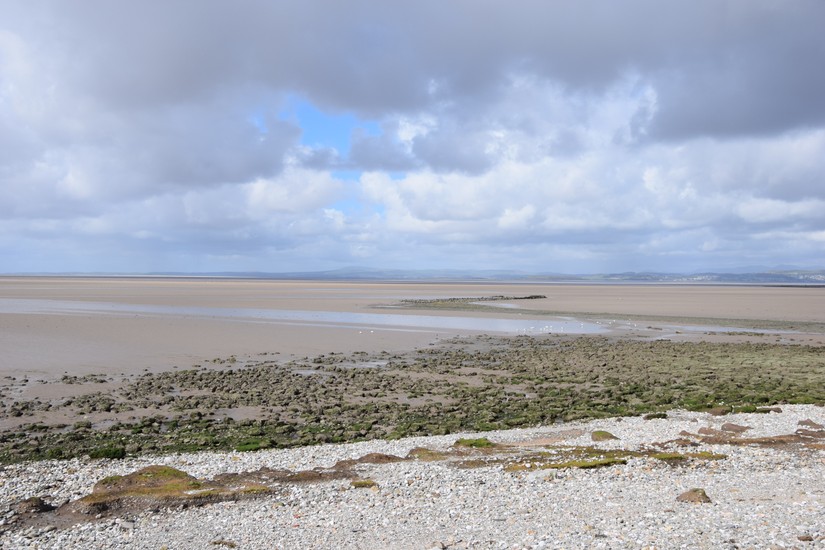
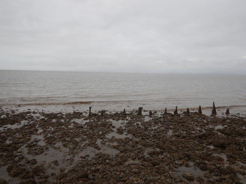
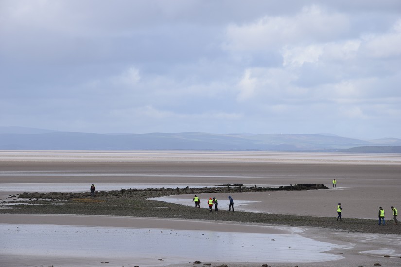
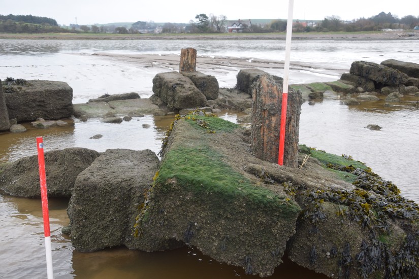
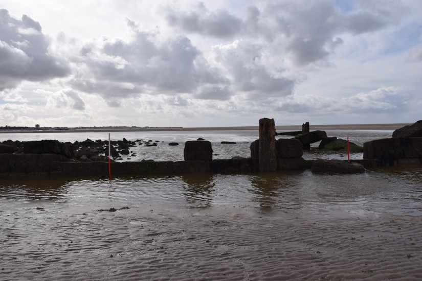
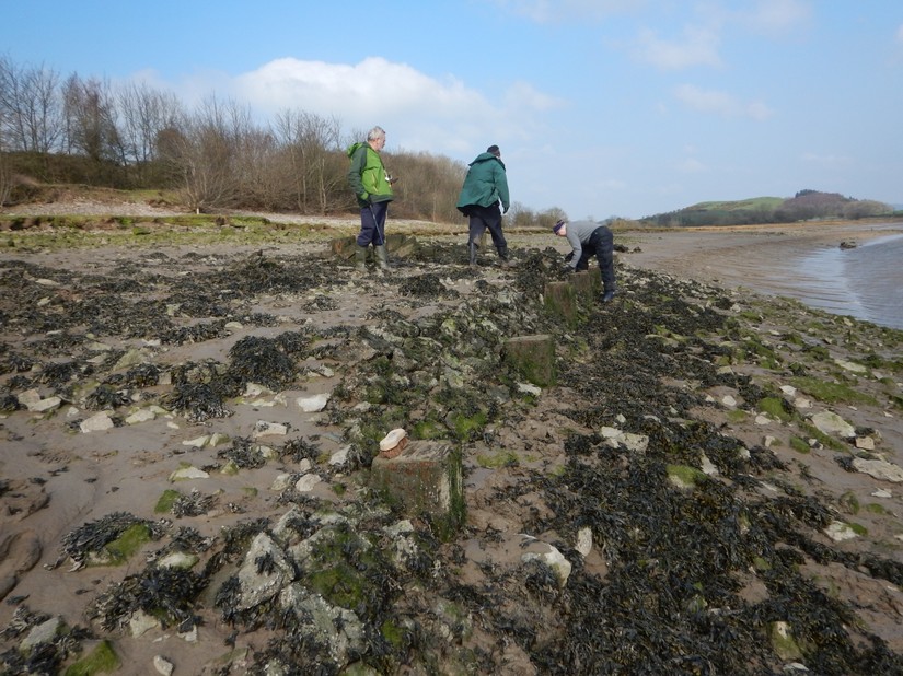
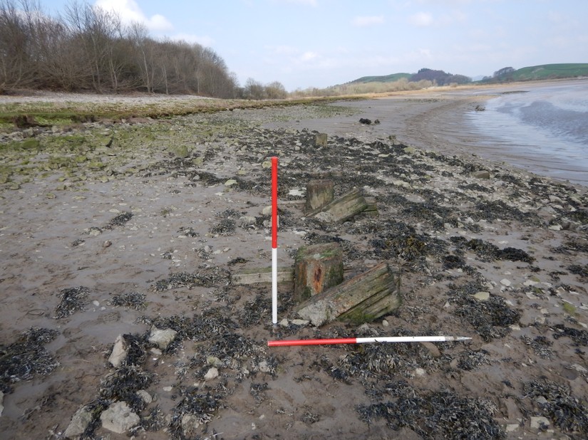
Two of the sites the Morecambe Bay Partnership community archaeology project with support from CITiZAN looked at between the 20th-24th March 2017 were late 18th/19th century coastal installations; the Hest Bank Jetty in the Morecambe Bay Area and Plumpton Pier at Ulverston. Hest Bank has been known since 2004 when one member of the public saw the site as it had been revealed. At this time, its substantial stone walls were still in place but by the time an archaeological survey was conducted by Oxford Archaeology in 2009, it had mostly collapsed and at the time of the most recent survey, the stone banking had almost entirely vanished, either washed away by the tide or buried once again beneath the sand. Thanks to local historians, we know it was a cargo jetty for the Hest Bank Canal Company and briefly used between 1819-1831 before the site was moved to Glasson Docks further up the bay and the jetty fell out of use.
The volunteers on site were able to offer unique insights into potential functions of the different jetty areas. For example, horizontal iron plates on one side was suggested to be a loading ramps for a ship’s cargo and the remains of a wooden pole at the northern end could have been a crane known as a ‘scotch derrick’. Another suggestion was that the pole was a temporary lighthouse or a turning place for ships (they would attach a rope on to it allowing the boat to turn around in the harbour). The iron shackles were also suggested to be hooks for ships to moor in too. Interestingly, one volunteer pointed out that the remains of the timbers on the jetty itself aligned perfectly with the train bridge, suggesting it originally linked up to the railway.
Further towards to the foreshore are several more wooden timbers which could have been part of the original structure or a wider complex. The remains of a more recent concrete jetty can also be seen. Littered across the bay are the remains of several concrete anti-glider poles, designed to make enemy forces arriving via glider divert to a more difficult or exposed location rather than the shoreline.
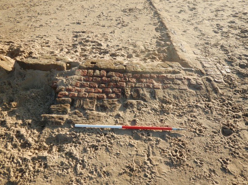
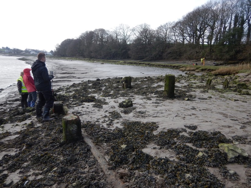
Plumpton Pier also dates to a similar period. The heavy timbers and substantial revetment wall are clearly visible on the foreshore as is one iron rail which suggests that a small track line adjoined the pier to supply iron ore deposits which are found in abundance around Ulverston as well as a nearby limestone quarry. We also know from historic records that iron working was a significant industry for the local people as monolithic slag deposits have been built up across the bay. The nearby Ulverston canal and pier were built to facilitate this industry but as the ships were too big use the canal, the canal gradually fell out of use and it was probable that around this time, the pier did as well.
Bibliography
The CITiZAN website contains most of the information regarding Hest Bank and Plumpton. Historic England’s website contains the rapid coastal zone assessments which give information on the nature as well as location for many of the sites across the coast. The Regional Research Framework has most of the information on the framework itself and its areas of interest.
Regional Research Framework (North West)
Hest Bank Jetty (82451)
Plumpton Pier (81696)
Heysham Fishing Weir (81730)
Formby Lifeboat House (81624)
Easington Coastal Gun Battery (22984)