Marsden Bay: a changing coastal landscape
28/02/2018 | Angus Stephenson (Citizan volunteer)
There are always easily visible cracks in the rocks at Marsden Bay, which look as if they are ready to collapse at any moment, although erosion is not as rapid in this area as on other parts of the north-east coast. This stretch of coast was notorious in historic times for shipwrecks and smuggling.
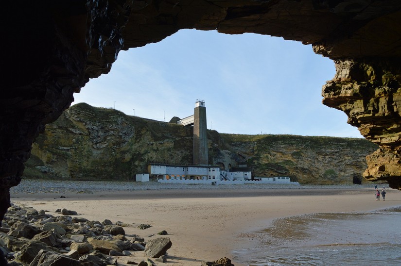
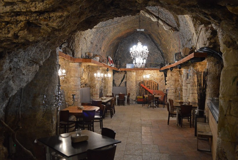
The two best known features of Marsden Bay are Marsden Rock, a limestone mass which is cut off from the mainland at high tide, and the pub in caves cut into the base of the cliffs, usually known in modern times as Marsden Grotto. The pub was originally opened by a former lead-miner who was handy with explosives, nicknamed “Jack the Blaster” appropriately enough, as his home in 1782. He also cut the steps down the cliff in more-or-less the same place as they are today. He was succeeded as the pub owner by a colourful, entrepreneurial Scotsman named Peter Allan, who developed the business in the early 19th century. Jack and Peter were both suspected, probably correctly, of being involved in smuggling and at least two murders connected with it took place in the bay. The pub eventually passed into the hands of the Vaux Brewery, who built the lift shaft from the cliff-top to the base in the 1930s, which is still in use today. After a recent period of closure, the pub reopened last year (2017) under new ownership by a local hotel group, who are currently working on converting part of the property into a hotel.
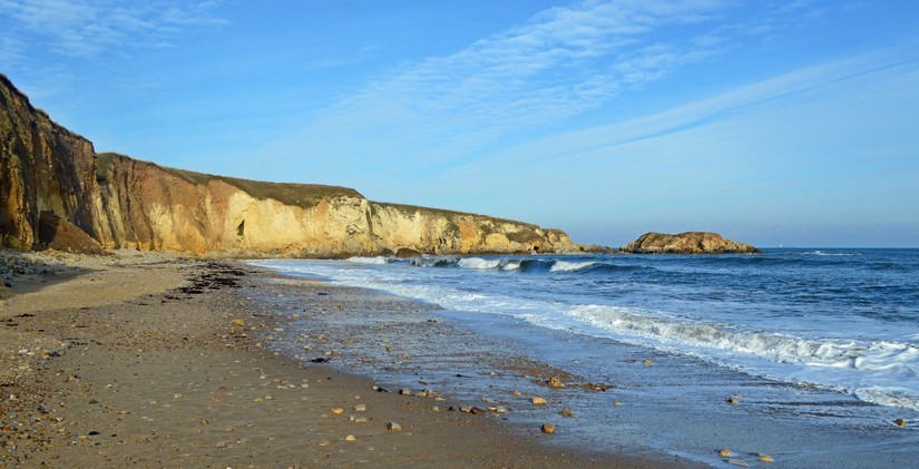
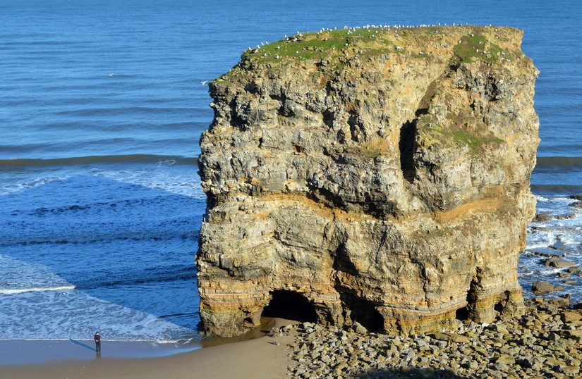
Marsden Rock itself is being steadily eroded by the sea and will presumably eventually completely disappear. For many years the Rock comprised an arch but in 1996 the roof of this arch collapsed, so that it was split into two stacks. The smaller of these was leaning dangerously to one side and it was blown up for safety the following year. One of the 19th century pub landlord, Peter Allan’s, schemes was to have steps cut into the Rock from about half way up, which he had done with two assistants in 1830. He then charged visitors for the use of his ladders to get to the bottom of the steps and for refreshments from his tent at the top. The heavily eroded steps can still be seen today. In 1903 a choral group put in a performance from the top of the rock for an audience on the mainland. Nowadays the most frequent visitors to the top are the bird population, mostly kittiwakes, cormorants and fulmar petrels.
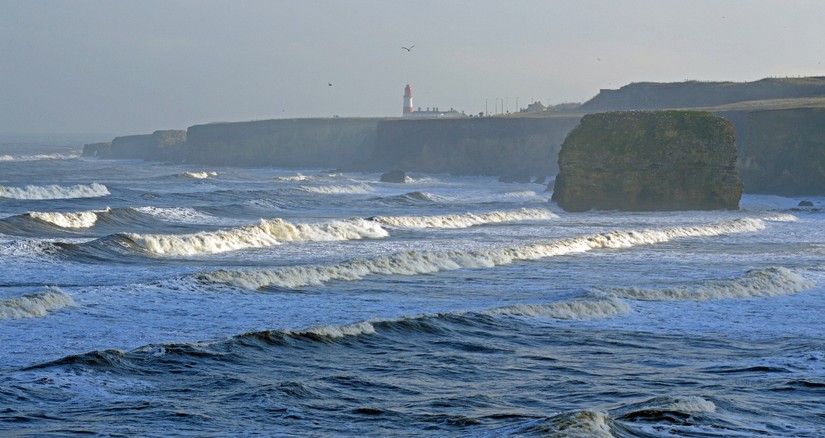
In 1871 the first step towards a dramatic transformation of the area took place, with the construction of the electrically-operated Souter Lighthouse. This was followed up by a new coal-mine, Whitburn Colliery, immediately to the south (also known as Marsden Colliery), lime-kilns immediately across the main coast road to the north-west, and the pit village of Marsden, immediately to the north of the lighthouse, for the miners and the quarrymen and their families. The whole series of industrial components were linked by a train between South Shields and Sunderland, known as the Marsden Rattler.
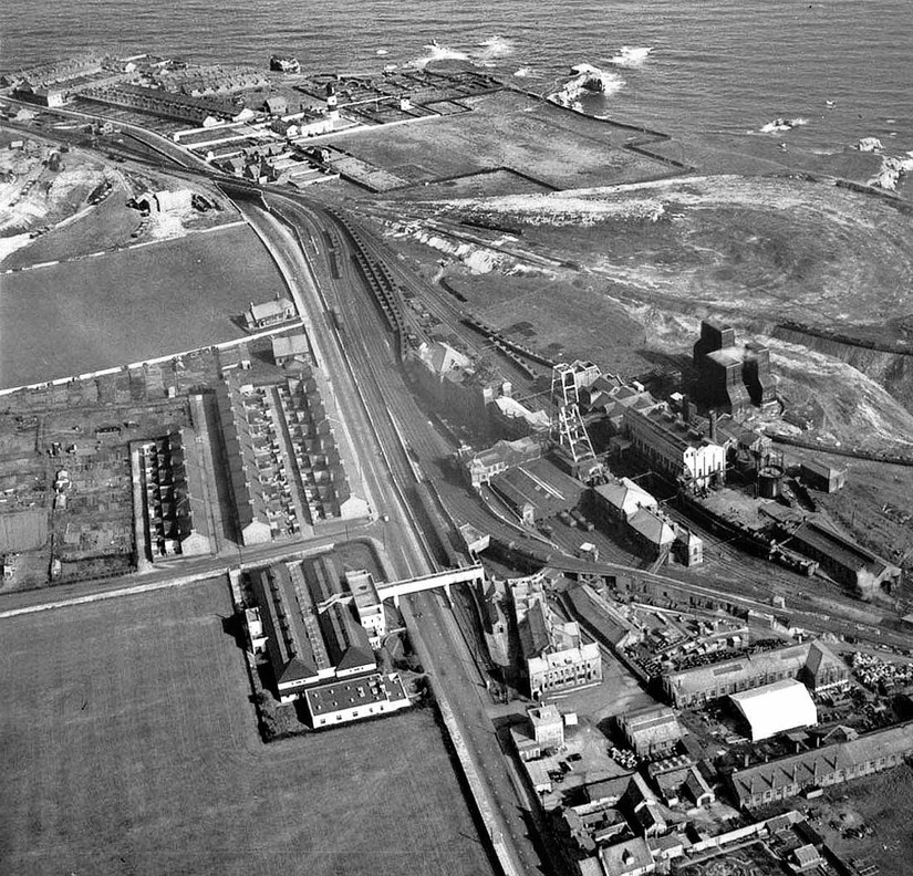
The picture above shows Whitburn Colliery at the bottom right; Souter Lighthouse towards the top, slightly to the left of centre; Marsden pit-village, just beyond it; and the lime-kilns across the road to the left. The line of the Marsden Rattler can be seen crossing the main road on a bridge towards the top left of the picture.
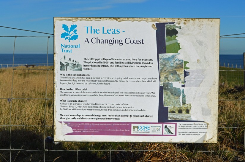
By 1968, the area was in decline. The lime-kilns had closed, the Marsden Rattler had ceased taking passengers and the decision was taken to close the mine and demolish the pit-village, which duly happened shortly afterwards. Souter Lighthouse was itself decommissioned in 1988, but continued to serve as a radio navigation beacon up until 1999 when it was finally closed; it is now opened to the public by the National Trust.
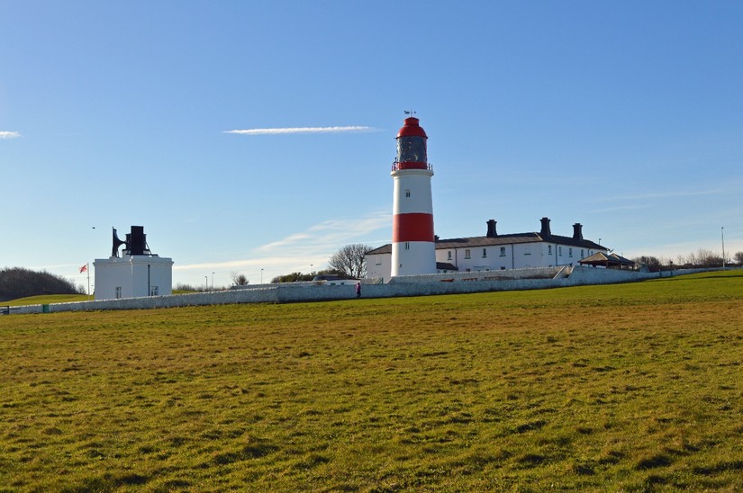
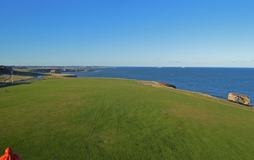
The picture below shows the field immediately to the north of the Souter Lighthouse, from which it was taken. This was the site of the former Marsden pit-village. In its heyday, this field contained 135 houses in 9 terraces, a Co-op, a post-office, a church and a Methodist chapel, a school, a reading room, a bowling green and allotments, all here on the exposed cliff-top. The decision was taken in 1968 to remove all trace of it, which has now more-or-less happened. There are still details of this former world to be found, the colliery gates, the eroding path from the village down the cliffs to the beach, but they are few and far between.
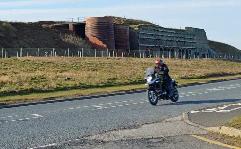
The lime-kilns, which went out of production in 1960, were the subject of a joint conservation scheme between Historic England and the owners recently, but it came to an abrupt end last year, when the latter group went into administration. They now sit rather forlornly in a sort of limbo across the coast road behind Heras fencing.
So now this area of former heavy industries is an amenity area, known locally as The Leas, and a country park for the Tyneside and Wearside conurbation, which surrounds it on the landward side, while the sea continues to chip away on the east. If you would like to know more about the area, you are recommended to visit this website.