Coastal Landscape Clues: New Brighton
23/03/2020 | Chris Kolonko
Archaeology isn't just about finding things and digging holes. A key component of archaeology is reading and understanding clues in the landscape to identify signs of human activity. This is known as 'Landscape Archaeology' and coastal landscapes are a prime location for us to investigate.
Although the coastline is ever-changing due to natural forces, such as coastal erosion, accretion, rising sea levels and storm events, human activity leaves its mark and continues to change the coastal environment to this day.
The use of documentary sources, such as old maps and aerial photographs are key to landscape archaeology. These resources are often used in conjunction with interpretation during field surveys to build up a detailed and accurate timeline of change.
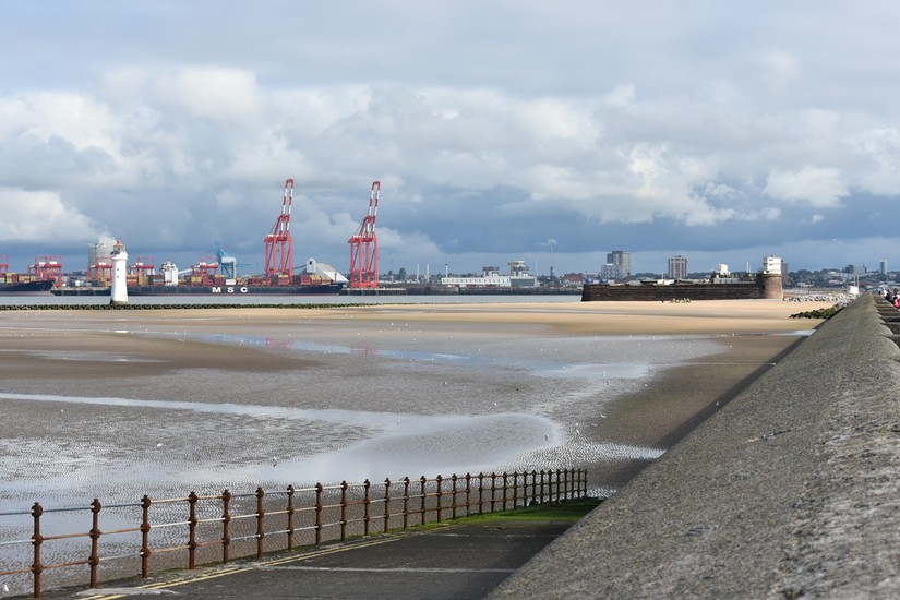
Team North's work in the Liverpool Bay Discovery Programme area has seen us focus on reading the landscape and recording changes to the urban coastal landscapes of the Mersey.
New Brighton, on the Northern corner of the Wirral peninsula, is a great place to do some landscape archaeology!
New Brighton developed from a coastal backwater to a thriving and popular coastal resort during the 19th and early 20th centuries. This development can be traced within the landscape if you know where to look.
Early New Brighton
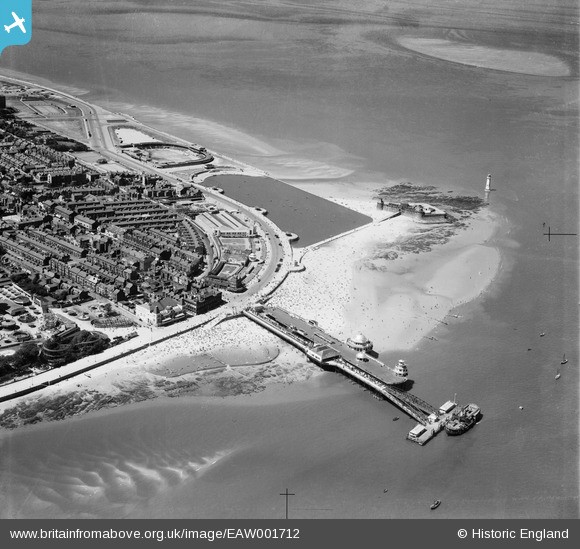
Much of the land that now makes up the coast edge and promenade of New Brighton has been reclaimed from the sea over the last 100 or so years. The original foreshore was around 150m further inland than it is today.
You can see the extent of the early foreshore in this Ordnance Survey Map from 1882.
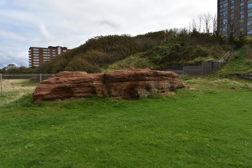
Some of the earliest evidence of human activity in the area comes from a lithics working site discovered on Red Noses. Excavation of the site yielded Mesolithic to Bronze Age debitage material, giving us a glimpse into the area’s prehistoric past. The area would have been very different 10,000 years ago, with forest and low lying marshy ground. The River Mersey was much smaller back then and not the large expanse of water we see today. The submerged forest that survives at Formby, to the north, would have originally extended across the front of New Brighton and as far south as Flintshire in Wales.
More recently, just over 100 years ago, New Brighton sat on clay and sandstone cliffs on the edge of the intertidal zone of the River Mersey. Human intervention, in the form of land reclamation and promenade construction, has taken place in stages between the late 1800s and 1930s. This has led to the earlier foreshore and cliff face being preserved within the present landscape.
The 19th century: Victorian Leisure and the Landscape
New Brighton started to develop from an isolated settlement on the banks of the Mersey into a resort for the local landed gentry during the 1800s. James Atherton kicked off this development in 1832.
Having observed this section of the Wirral from his house in Everton, he decided to buy a stretch of land and begin developing what was then a relatively small village. His intention was to turn this New Brighton (based on Brighton in the South) into a resort for the local rich.
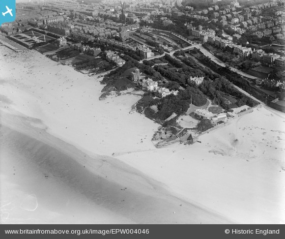
Atherton's proposal involved creating a street plan for the new town, along with a beach front, pier and church. The gridded street plan devised by Atherton can still be seen on modern aerial photographs and maps. Opulent villas were also constructed along the cliff line to house the well-off target-audience of Atherton’s plan.
The late Victorian period saw the development of many coastal towns into resorts where people could take in the coastal air and perambulate along the promenade. New Brighton was no different, developing from an exclusive resort for the local elite, into a booming and popular tourist resort for all people; many seeking time away from the industrial towns and cities of Lancashire and nearby Liverpool. Several of Atherton’s villas, mentioned earlier, were converted into cheap boarding houses to support the booming tourist trade.
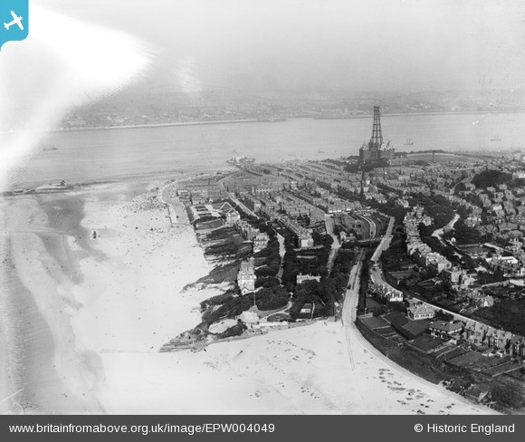
New Brighton’s Northern promenade developed towards the end of the 19th century. The riverfront from Egremont to New Brighton, sometimes known as the ‘sea front without a sea view’, was developed around 1897. Eventually the riverfront promenades between New Brighton, Egremont and Seacombe were joined to create the longest promenade in the UK.
The development of the eastern extent of foreshore in 1899 can be seen in this Ordnance Survey Map. The area around The Palace has been developed significantly since the earlier 1882 map was published.
Regressive mapping of the riverfront area shows the later promenade gradually spreading from east to west. This promenade sealed the riverfront, slipways and cliffs to the east of New Brighton.
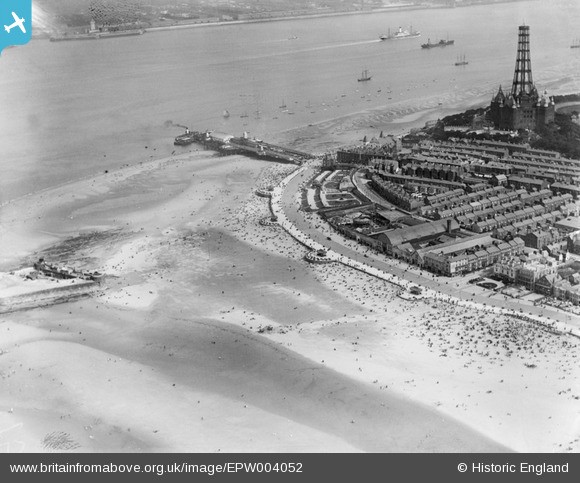
By 1911, yet another promenade had been constructed in front of what is now the Floral Pavilion Theatre. This extended further onto the foreshore and sealed the circa 1897 promenade. The addition of four ornate cast-iron shelters located on rounded promontories provided somewhere to shelter and sit while taking in the sea air.
Art Deco Development
The rapid development of the New Brighton beachfront calmed for the next two decades until the rise of the Art Deco style.
Construction of New Brighton’s final prom commenced from 1931. This massive undertaking would include the construction of an open air swimming baths (which was set to become the largest of its type in Europe), a marine lake and a range of Art Deco style shelters and pavilions.
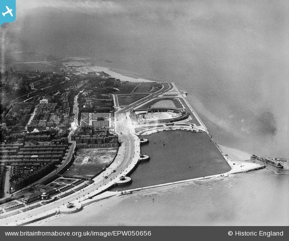
Construction of the promenade we see today was completed in 1939, with the Second World War bringing a halt to further expansion. This is probably the reason why the road stops so abruptly on the prom’s western extent around Harrison Drive. It had taken three years to build, with a cost of £531,000 (£34 million today).
The construction of the new New Brighton promenade also provided a practical sea defence and a barrier to the frequent besanding that plagued the area.
Landscape Clues
While walking along the promenade of New Brighton, it is possible to pick out clues and features in the landscape that highlight the development of the local beachfront.
It is also possible to map these phases. By doing so we can see how much of the current landscape of New Brighton has been reclaimed from the sea. Mapping also helps us get an understanding of the chronology of this development.
As mentioned before, the earliest phase of land reclamation sealed the New Brighton sandstone cliffs and foreshore. The cliffs known as Red Noses and Yellow Noses are still prominent in the landscape; representing the earliest visible phase. This line of cliffs can still be followed from west to east as you walk along the prom. The land to the south of Ian Fraser Walk has all been reclaimed.
The 1930s Art Deco shelters and pavilion on King’s Parade act as a visual indicator of the final period of land reclamation in the early 20th century.
The final period of promenade construction in the 1930s is clearly highlighted in this OS map from 1967.
The villas that sit on the cliff line above Pilot's Way are a clue to the early development of New Brighton under Atherton. These are the villas built for the local elite which still sit on Atherton’s early street plan.
The point where King’s Parade intersects Pilots Way marks the northern extent of the foreshore circa 1898; with Pilots Way following the line of the foreshore to the west. The now land-locked Lifeboat House and Marine Park provide tangible links to the 1890s foreshore.
Note the location of Marine Park in this OS map from 1899.
As you reach the Marine Lake there are two clear phases of promenade visible. The earliest phase, dating to around 1911, is represented by the three ornate shelters and the rounded promontories. This feature marks the coast edge in the early 20th century. The Marine Lake was constructed in front of the earlier prom; sealing it in the landscape. If you look close enough you’ll also be able to see the different materials and construction techniques used to build both examples.
As you can see, it is possible to trace the development of New Brighton. There are many more coastal landscape clues in and around New Brighton which will come to light in the upcoming Low Tide Trail.
Want to read more? Find out about CITiZAN volunteer Tijana's detective work surrounding the wartime graffiti at Richborough Port
Sources
Historyofwallasey.co.uk. 2020. History Of Wallasey | The Seafront Without A Sea View. [online] Available at: <http://www.historyofwallasey.co.uk/wallasey/the_seafront_without_a_sea_view/> [Accessed 20 March 2020]
Historyofwallasey.co.uk. 2020. Wallasey People | James Atherton. [online] Available at: <http://www.historyofwallasey.co.uk/wallasey/James_Atherton/index.html> [Accessed 20 March 2020].