Outreach at Blyth
16/09/2016 | Angus Stephenson (Citizan volunteer)
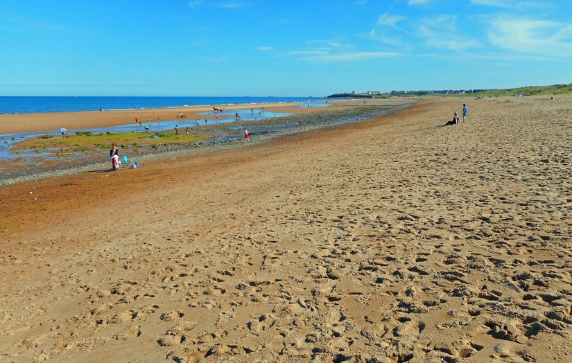
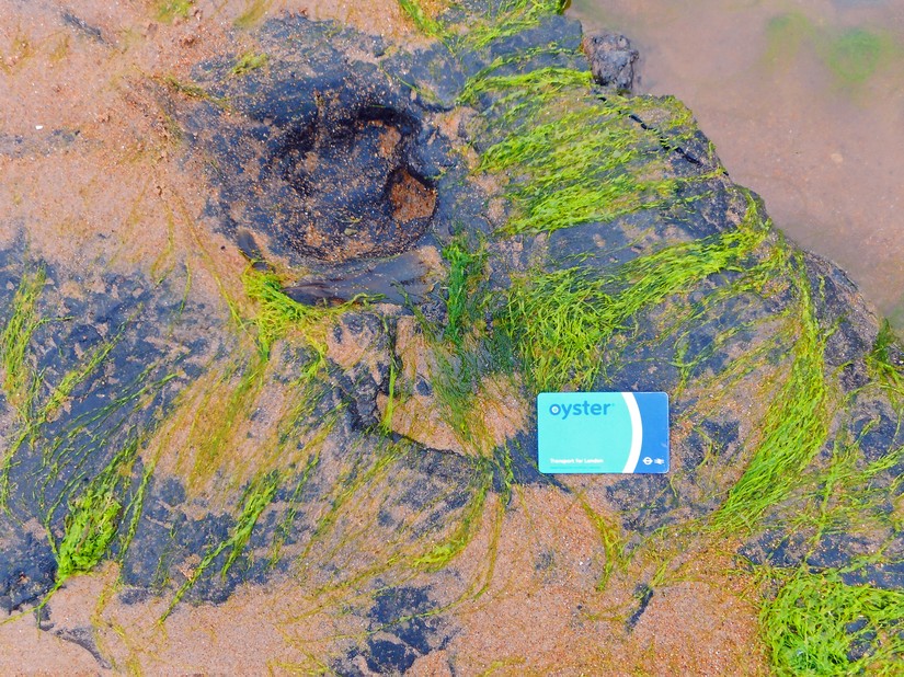
Blyth is an industrial port on the coast of Northumberland, which is getting ready to host the Tall Ships event this weekend, August 2016. This is the beach to the south of Blyth looking towards Seaton Sluice. The green seaweed-covered area on the foreshore and the darker area to the right are part of the submerged landscape beneath the North Sea, usually called Doggerland.
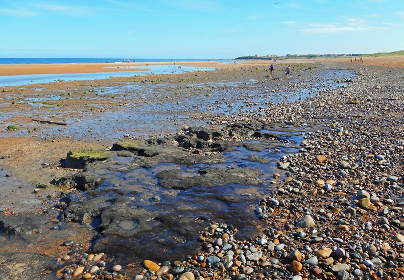
The submerged landscape is represented by a thin layer of dark peat above grey clay with the remains of tree-stumps sticking up through it. The surface has many animal hoof-prints surviving in it, implying that the inundation, when it came, was a sudden and rapid event.
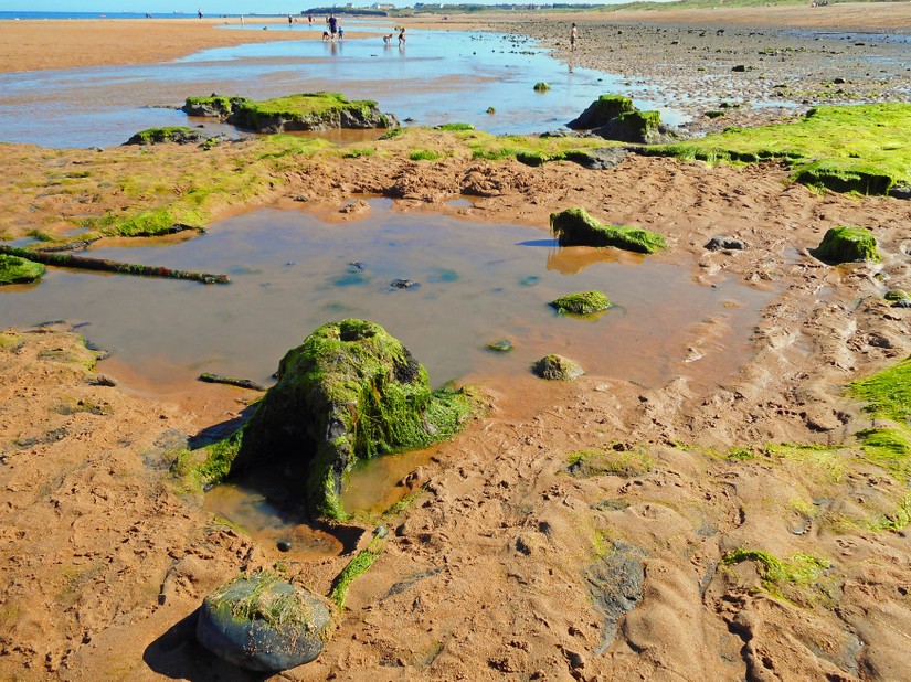
These are tree-stumps covered in seaweed, which are visible at low tide and have been sampled for species identification. The big one on the left is part of an ash tree.
These are hoof-prints of red deer and there are possibly tracks of other species of animals in the surface of the peat as well.
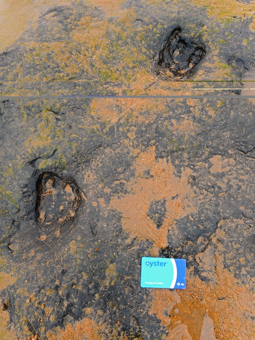
Samples have been taken for carbon-dating purposes and it is most likely that these remains will be dated to the Mesolithic period when Britain became an island, as elsewhere along the coast, maybe around 6,000 BC. The results will be posted here later.
This was a CITiZAN outreach event, run in partnership with the Bamburgh Research Group and Historic England.
If you'd like to know more about how to record prehistoric footprints, including downloadable targets so you can record your own, check out our resources section.